File:Maritime Claims Of Peru.svg
This file was derived from: Maritime Claims of Peru and Ecuador.svg
Author
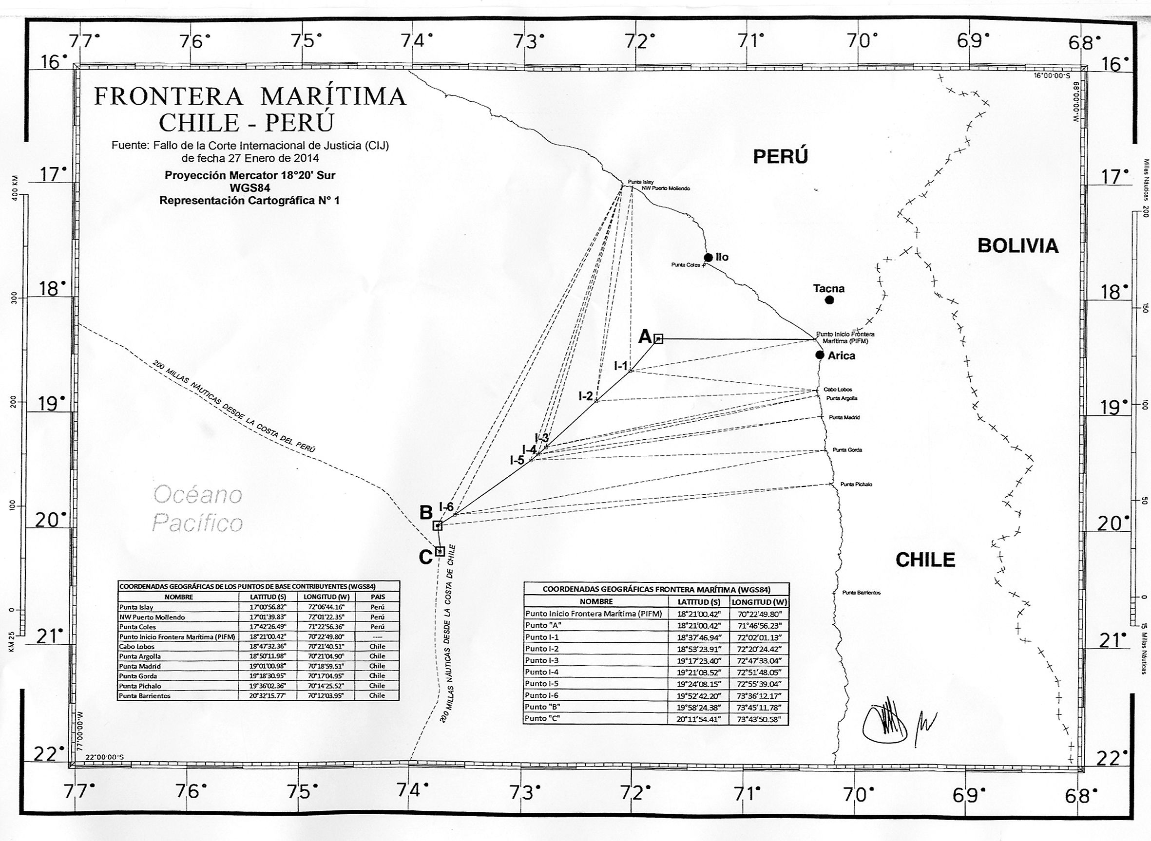
- Coordenadas del límite marítimo entre Chile y Perú se definen en actas (Mapa)
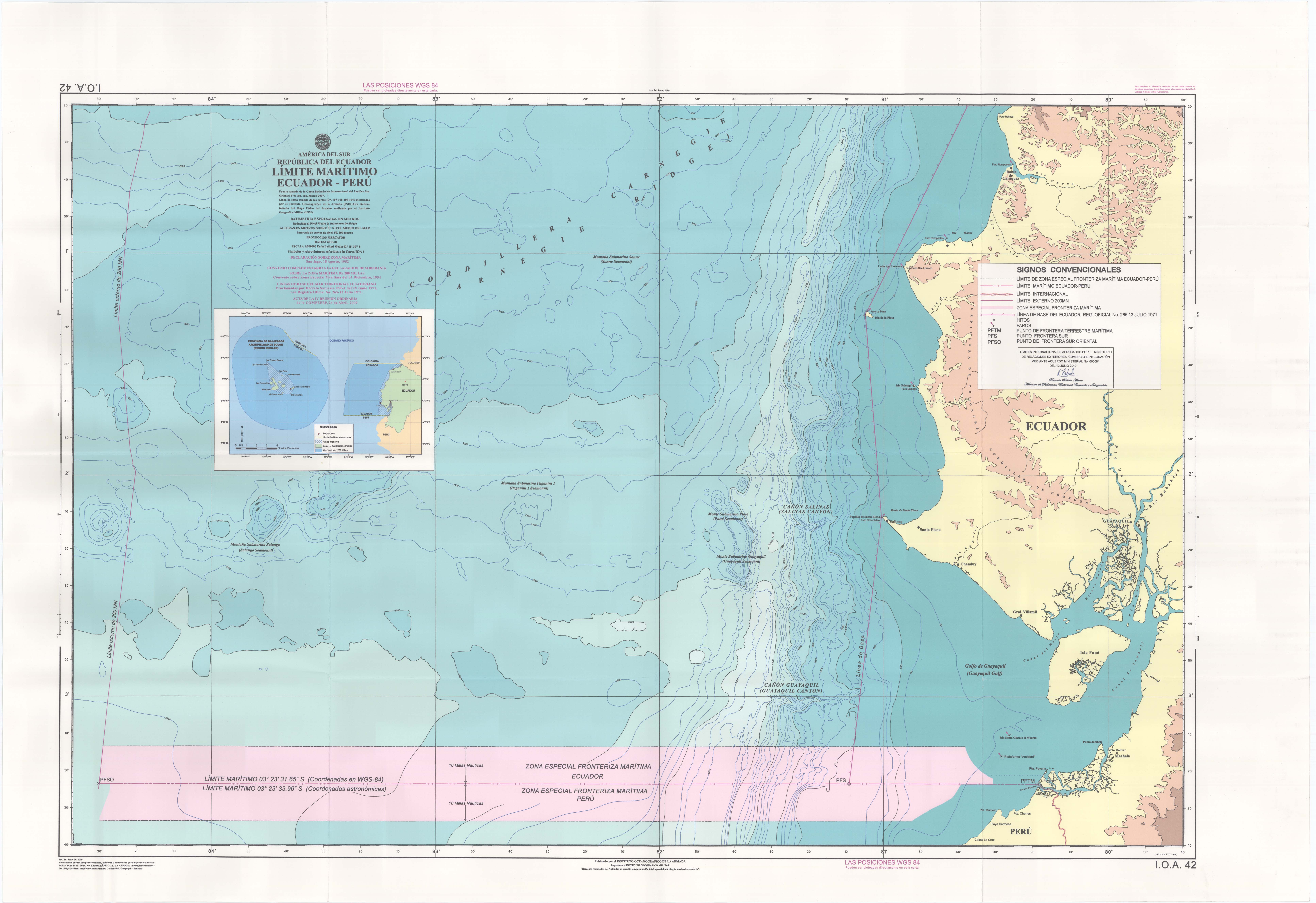
- Límite maritimo Ecuador-Perú
- Ley de Líneas de base del dominio marítimo del Perú, con mapas. Ley 28621 (2005)
- Ley que adecua las líneas de base del dominio marítimo del Perú, con mapa. Ley 29687 (2011)
- Memorial del Gobierno del Perú sobre la controversia marítima Perú vs. Chile
- Maritime_Claims_of_Peru_and_Ecuador.svg: GeoEvan
- derivative work: Milenioscuro
Licensing
I, the copyright holder of this work, hereby publish it under the following license:
This file is licensed under the Creative Commons Attribution-Share Alike 3.0 Unported license.
- You are free:
- to share – to copy, distribute and transmit the work
- to remix – to adapt the work
- Under the following conditions:
- attribution – You must give appropriate credit, provide a link to the license, and indicate if changes were made. You may do so in any reasonable manner, but not in any way that suggests the licensor endorses you or your use.
- share alike – If you remix, transform, or build upon the material, you must distribute your contributions under the same or compatible license as the original.
Original upload log
This image is a derivative work of the following images:
- File:Maritime_Claims_of_Peru_and_Ecuador.svg licensed with Cc-by-sa-3.0
Uploaded with derivativeFX

