Loading
  • 21 Aug, 2019

  • By, Wikipedia

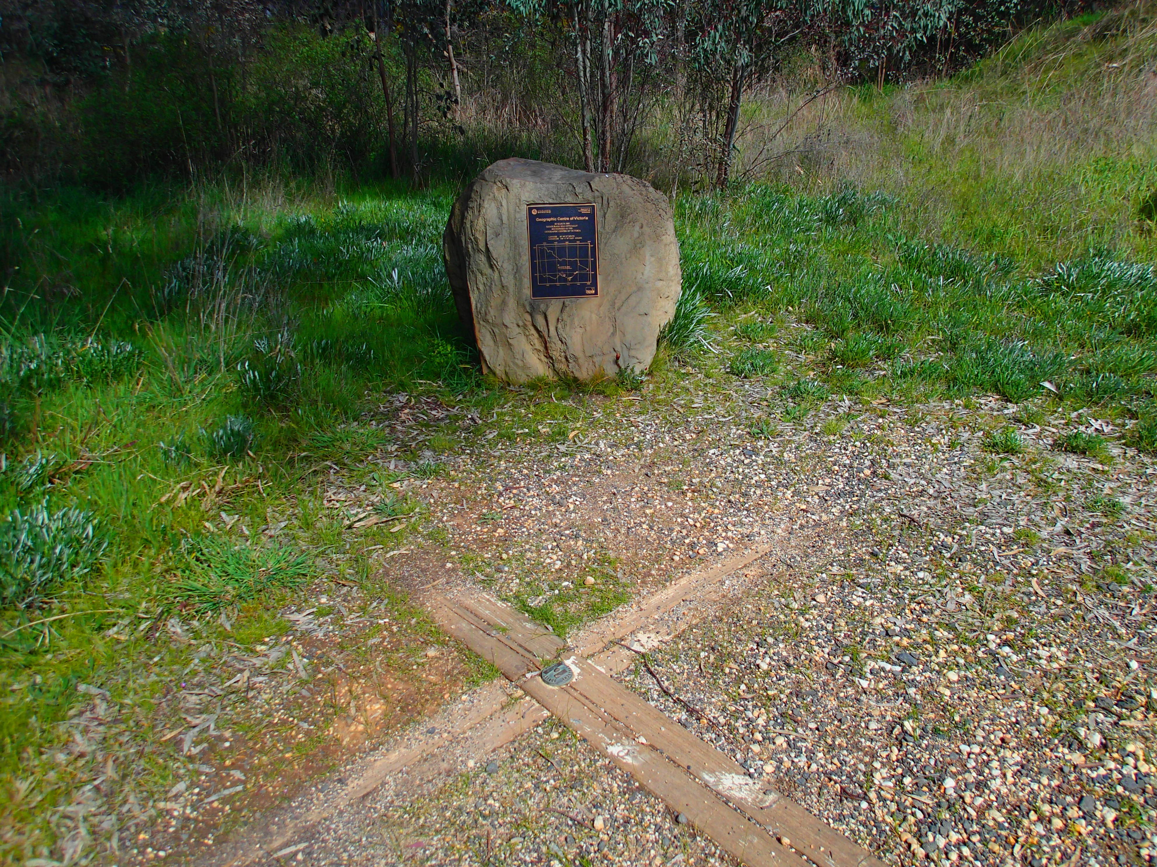
File:Marker Of The Centre Of Victoria.jpg

The plaque reads: Geographic Centre of Victoria In March 2001 Mandurang was officially recognised as the geographic centre of Victoria. Latitude: 36° 49' 23" South

Longitude: 144° 17' 39" East (GDA 94).
Date Source Own work Author Asfridhr

Licensing

I, the copyright holder of this work, hereby publish it under the following license:
w:en:Creative Commons
attribution share alike
This file is licensed under the Creative Commons Attribution-Share Alike 4.0 International license.
You are free:
  • to share – to copy, distribute and transmit the work
  • to remix – to adapt the work
Under the following conditions:
  • attribution – You must give appropriate credit, provide a link to the license, and indicate if changes were made. You may do so in any reasonable manner, but not in any way that suggests the licensor endorses you or your use.
  • share alike – If you remix, transform, or build upon the material, you must distribute your contributions under the same or compatible license as the original.

Captions

Add a one-line explanation of what this file represents

Items portrayed in this file

depicts

16 September 2017

2,498,752 byte

2,976 pixel

3,968 pixel

image/jpeg

60eda77ec265f2ae125115038354e68ecb1dc045

0.008 second

4.5 millimetre

File history

Click on a date/time to view the file as it appeared at that time.

Date/TimeThumbnailDimensionsUserComment
current10:00, 11 November 2017Thumbnail for version as of 10:00, 11 November 20173,968 × 2,976 (2.38 MB)AsfridhrCross-wiki upload from en.wikipedia.org

The following 2 pages use this file:

Metadata