File:MarsCuriosityRover-TraverseMap-Sol-0746-20140911.jpg
Curiosity's Traverse Map Through Sol 746 - Arrival at the slopes of Mount Sharp in Gale Crater on the planet Mars.
http://mars.jpl.nasa.gov/msl/multimedia/images/?ImageID=6587
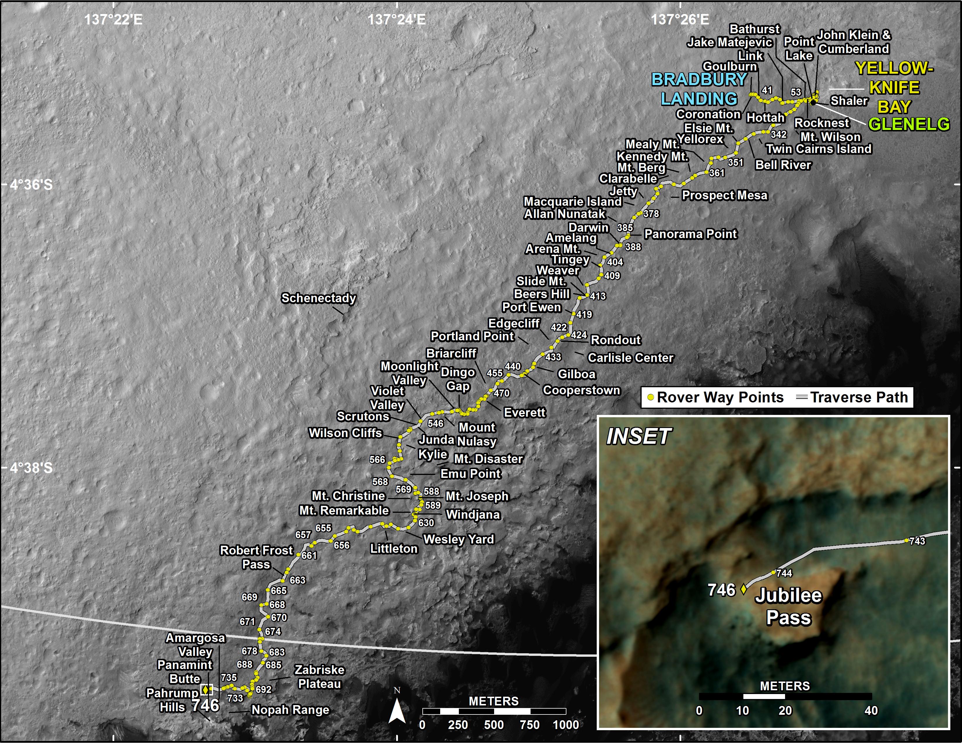
This map shows the route driven by NASA's Mars rover Curiosity through the 746 Martian day, or sol, of the rover's mission on Mars (September 11, 2014).
Numbering of the dots along the line indicate the sol number of each drive. North is up. The scale bar is 1 kilometer (~0.62 mile). From Sol 744 to Sol 746, Curiosity had driven a straight line distance of about 26.19 feet (7.983 meters).
The base image from the map is from the High Resolution Imaging Science Experiment Camera (HiRISE) in NASA's Mars Reconnaissance Orbiter.
