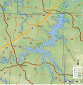
File:Meramec Park Lake Propose V4.svg
Click on a date/time to view the file as it appeared at that time.
| Date/Time | Thumbnail | Dimensions | User | Comment | |
|---|---|---|---|---|---|
| current | 04:58, 14 June 2022 |  | 1,064 × 1,083 (2.68 MB) | Kbh3rd | Missouri supplemental route MM was mislabeled as HH and is corrected here |
| 03:25, 10 September 2013 |  | 1,064 × 1,083 (2.68 MB) | Kbh3rd | Show roads under lake with 50% opacity because the author has no information as to whether any of them were intended to bridge the reservoir. | |
| 17:15, 19 September 2012 |  | 1,064 × 1,083 (2.42 MB) | Kbh3rd | Standard color scheme for topo and smaller file size, same great taste. | |
| 16:55, 10 September 2012 |  | 1,064 × 1,083 (3.35 MB) | Kbh3rd | Simplified SVG for faster loading and rendering | |
| 04:24, 26 August 2012 |  | 1,064 × 1,083 (3.69 MB) | Kbh3rd | User created page with UploadWizard |
File usage
The following 4 pages use this file: