File history
Click on a date/time to view the file as it appeared at that time.
| Date/Time | Thumbnail | Dimensions | User | Comment | |
|---|---|---|---|---|---|
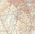
| current | 23:30, 22 December 2006 |  | 2,560 × 2,513 (6.52 MB) | Daderot | {{Information |Description=Map of Monatiquot River (Massachusetts). |Source=This image has been stitched together from the following USGS maps: USGS 7.5 Minute Series, Blue Hills, MA Quadrangle, 1941, northeast corner; USGS 7.5 Minute Series, Weymouth, MA |
File usage
The following 2 pages use this file: