File:Mumbai 03-2016 52 Dharavi Near Mahim Junction.jpg
Thank you.
| Camera location | | View this and other nearby images on: OpenStreetMap |
|---|
|
This image was selected as picture of the day on Wikimedia Commons for 26 January 2017. It was captioned as follows: Other languages:
|
This image was selected as picture of the day on Bengali Wikipedia.
|
| Copyleft: This work of art is free; you can redistribute it and/or modify it according to terms of the Free Art License. You will find a specimen of this license on the Copyleft Attitude site as well as on other sites. |
Click on a date/time to view the file as it appeared at that time.
| Date/Time | Thumbnail | Dimensions | User | Comment | |
|---|---|---|---|---|---|
| current | 00:16, 10 April 2016 | 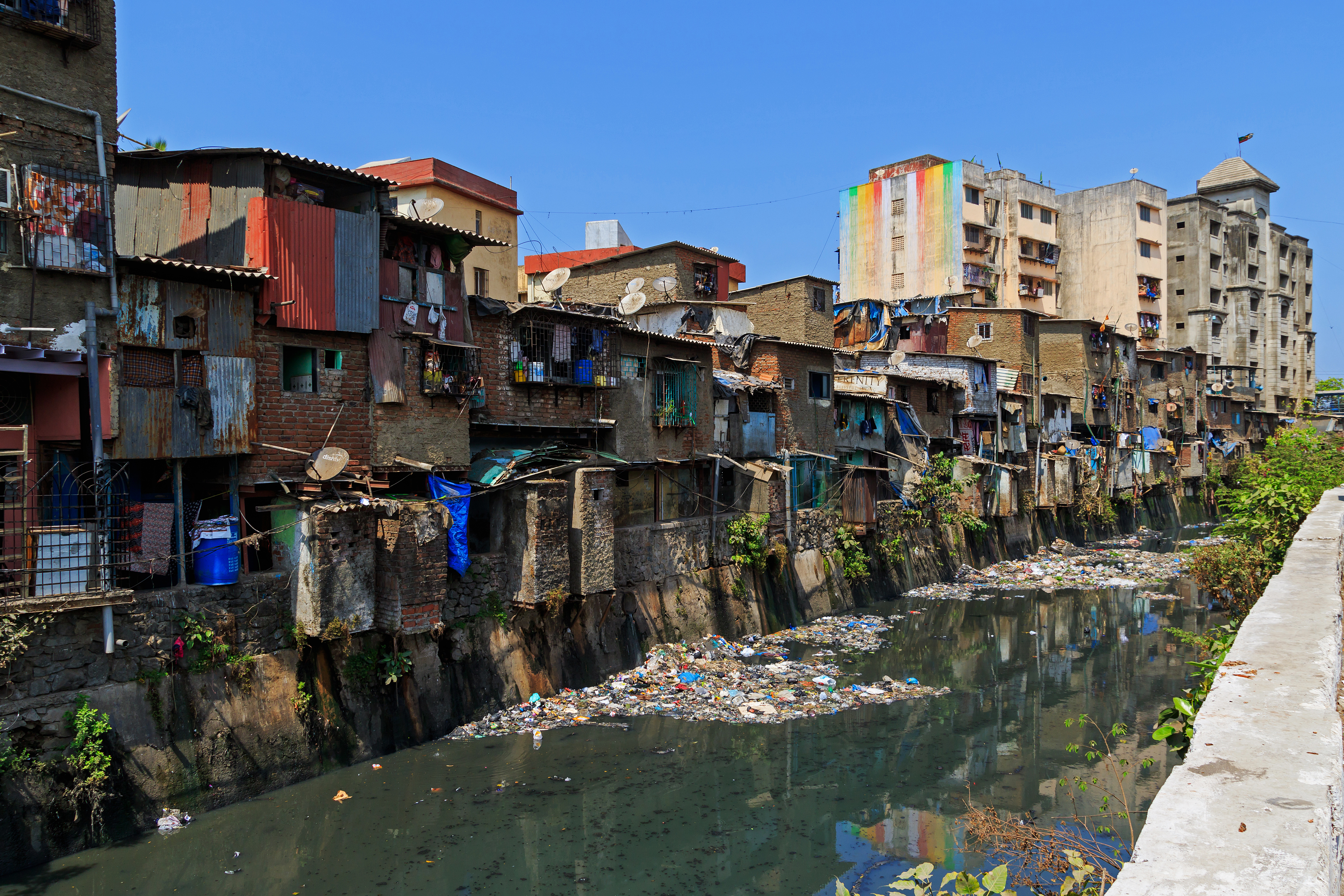 | 5,273 × 3,515 (8.67 MB) | A.Savin | {{User:A.Savin/F |Description= {{en|Dharavi settlement near Mahim Junction in Mumbai, India}} {{ru|Район Дхарави близ станции Mahim Junction в Бомбее, Индия}} |Year=2016 |Month=03 |Day=14}} {{Location|19|2|32.7|N|72|5... |
The following other wikis use this file:
View more global usage of this file.