This work is in the public domain in its country of origin and other countries and areas where the copyright term is the author's life plus 100 years or fewer.
You must also include a United States public domain tag to indicate why this work is in the public domain in the United States.
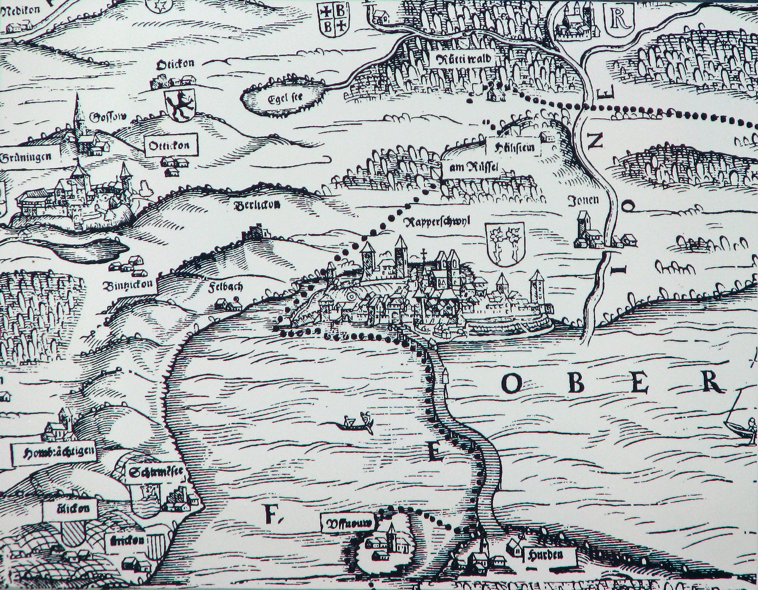
== Summary == {{Information |Description={{de|Das obere Zürichseegebiet um Rapperswil (SG) mit den ausgedehnten Wäldern (Rütner und Joner Wald) auf der Karte von Josias Murer aus dem Jahr 1566. Nebst he
 You must also include a United States public domain tag to indicate why this work is in the public domain in the United States.
