File:NPS American-samoa-context-map.jpg
Click on a date/time to view the file as it appeared at that time.
| Date/Time | Thumbnail | Dimensions | User | Comment | |
|---|---|---|---|---|---|
| current | 18:35, 13 May 2017 | 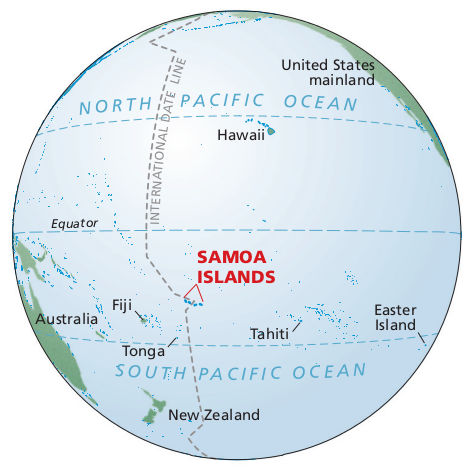 | 471 × 471 (40 KB) | RKBot | =={{int:filedesc}}== {{Information |description= {{en|1=Pacific ocean map showing where American Samoa is in relation to the Equator, Fiji, Tahiti, Tonga, Hawaii, and the U.S. mainland – way out there in the Pacific Ocean.}} |date= 2016-02-22 |source... |
File usage
The following pages on the English Wikipedia use this file (pages on other projects are not listed):