File:NPS Great-sand-dunes-backcountry-map.jpg
Click on a date/time to view the file as it appeared at that time.
| Date/Time | Thumbnail | Dimensions | User | Comment | |
|---|---|---|---|---|---|
| current | 23:31, 16 May 2017 | 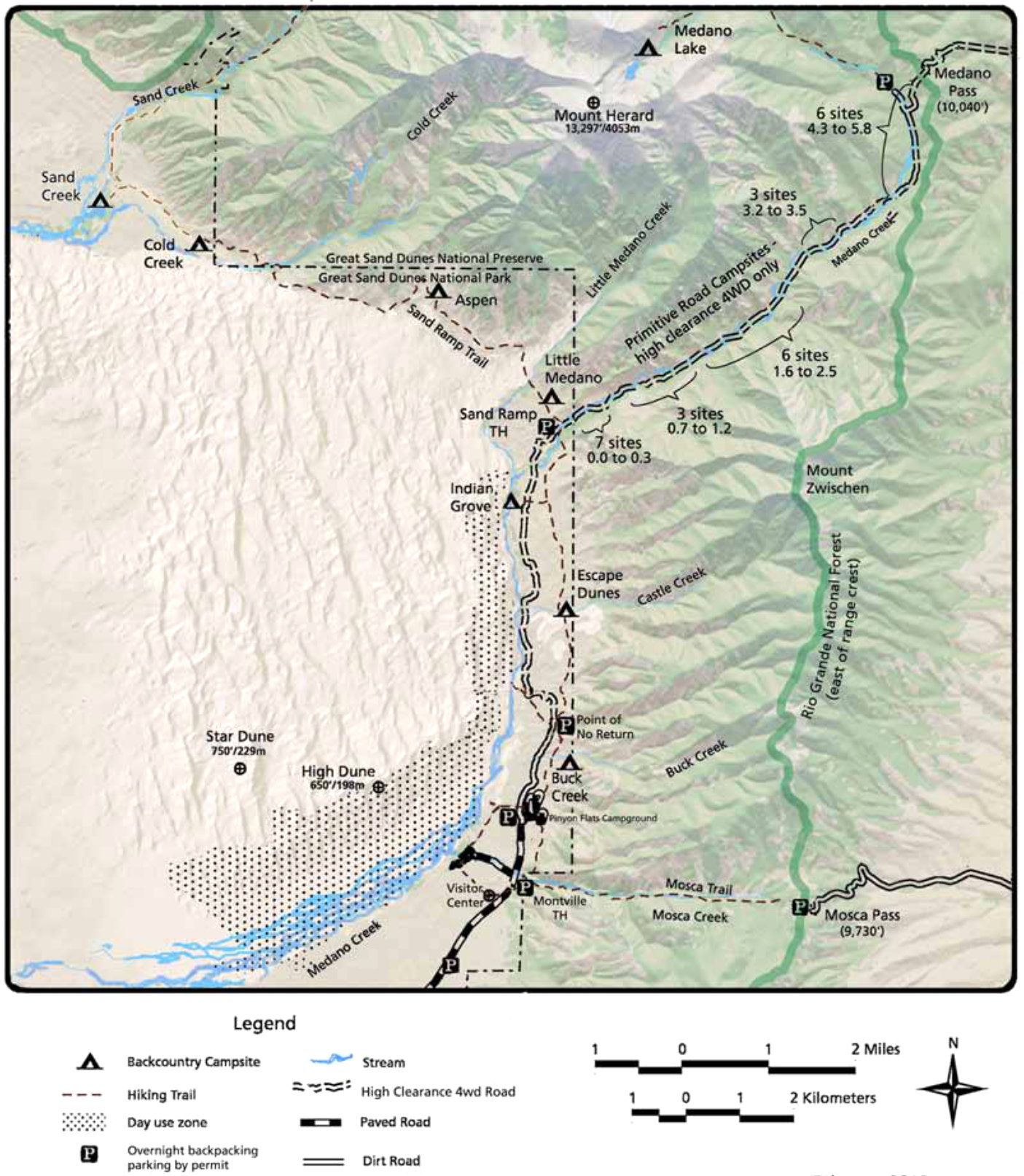 | 1,405 × 1,614 (388 KB) | RKBot | =={{int:filedesc}}== {{Information |description= {{en|1=The Great Sand Dunes backcountry map shows backcountry campsites and trails into the Sangre de Cristo Mountains as well as those that follow the boundaries of the dune field.}} |date= 2013-11-14 |... |
File usage
The following pages on the English Wikipedia use this file (pages on other projects are not listed):