File:NPS Virgin-islands-map.jpg
Click on a date/time to view the file as it appeared at that time.
| Date/Time | Thumbnail | Dimensions | User | Comment | |
|---|---|---|---|---|---|
| current | 09:50, 17 May 2017 | 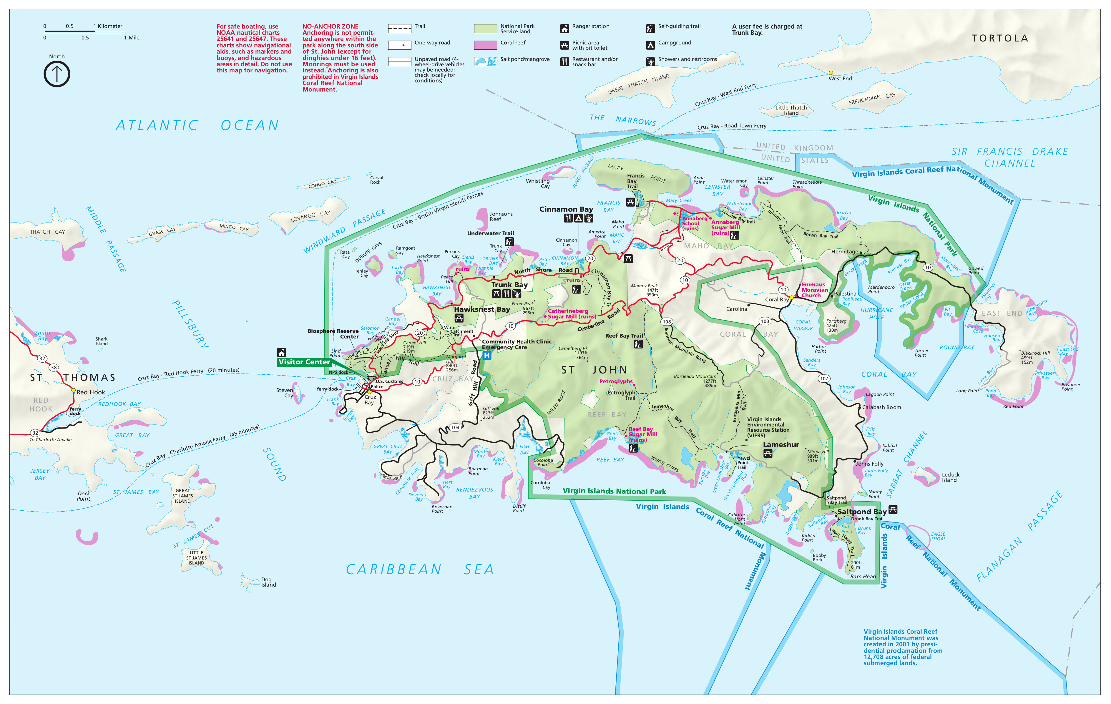 | 3,775 × 2,392 (1.26 MB) | RKBot | =={{int:filedesc}}== {{Information |description= {{en|1=Official map of Virgin Islands National Park, including Trunk Bay, Cinnamon Bay, and other locations on St. John.}} |date= 2015-08-01 |source= U.S. National Park Service (http://npmaps.com/wp-cont... |
File usage
The following page uses this file:
Global file usage
The following other wikis use this file:
- Usage on ar.wikipedia.org