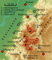
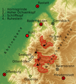
File:Nationalpark-Schwarzwald-Lageplan.png
Click on a date/time to view the file as it appeared at that time.
| Date/Time | Thumbnail | Dimensions | User | Comment | |
|---|---|---|---|---|---|
| current | 01:34, 8 July 2014 |  | 724 × 839 (820 KB) | Sitacuisses | clarity |
| 09:03, 8 June 2014 |  | 724 × 839 (786 KB) | Sitacuisses | + Rhein, Murg; ... | |
| 00:06, 6 June 2014 |  | 724 × 839 (775 KB) | Sitacuisses | various modifications | |
| 06:23, 4 June 2014 |  | 735 × 809 (658 KB) | Sitacuisses | scale and more | |
| 05:03, 4 June 2014 |  | 735 × 809 (650 KB) | Sitacuisses | {{Information |Description ={{en|1=The north western Black Forest with the Black Forest National Park (Nationalpark Schwarzwald). Map based on NASA SRTM-3 data.}} {{de|1=Lage des Nationalparks Schwarzwald im nordwest... |
File usage
The following pages on the English Wikipedia use this file (pages on other projects are not listed):
Global file usage
The following other wikis use this file:
- Usage on arz.wikipedia.org
- Usage on ast.wikipedia.org
- Usage on bh.wikipedia.org
- Usage on bn.wikipedia.org
- Usage on cbk-zam.wikipedia.org
- Usage on ckb.wikipedia.org
- Usage on da.wikipedia.org
- Usage on de.wikipedia.org
- Usage on dty.wikipedia.org
- Usage on fo.wikipedia.org
- Usage on gu.wikipedia.org
- Usage on hi.wikipedia.org
- Usage on it.wikipedia.org
- Usage on kn.wikipedia.org
- Usage on lg.wikipedia.org
- Usage on mai.wikipedia.org
- Usage on ml.wikipedia.org
- Usage on my.wikipedia.org
- Usage on ne.wikipedia.org
- Usage on nl.wikipedia.org
- Usage on pa.wikipedia.org
- Usage on pl.wikipedia.org
- Usage on simple.wikipedia.org
- Usage on si.wikipedia.org
- Usage on sr.wikipedia.org
- Usage on te.wikipedia.org
- Usage on tum.wikipedia.org
View more global usage of this file.