Click on a date/time to view the file as it appeared at that time.
| Date/Time | Thumbnail | Dimensions | User | Comment |
|---|
| current | 14:22, 7 January 2014 | 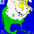 | 512 × 512 (18 KB) | Oaktree b | {{Information |Description ={{en|1=Snow and ice map from the NOAA, showing snow cover from northern Canada down to Texas.}} |Source =Downloaded from: http://www.natice.noaa.gov/pub/ims/ims_gif/DATA/cursnow_usa.gif on January 7, 2014 |Author... |
The following pages on the English Wikipedia use this file (pages on other projects are not listed):
The following other wikis use this file:
- Usage on de.wikipedia.org
- Usage on es.wikipedia.org
- Usage on nl.wikipedia.org
- Usage on ru.wikipedia.org
- Usage on ru.wikinews.org
This file contains additional information, probably added from the digital camera or scanner used to create or digitize it.
If the file has been modified from its original state, some details may not fully reflect the modified file.

