Click on a date/time to view the file as it appeared at that time.
| Date/Time | Thumbnail | Dimensions | User | Comment |
|---|
| current | 03:37, 6 February 2011 | 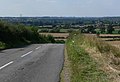 | 640 × 436 (97 KB) | GeographBot | == {{int:filedesc}} == {{Information |description={{en|1=Normanton Lane towards Normanton on Soar}} |date=2007-09-04 |source=From [http://www.geograph.org.uk/photo/551211 geograph.org.uk] |author=[http://www.geograph.org.uk/profile/11776 Mat Fascione] |pe |
The following page uses this file:
The following other wikis use this file:
- Usage on azb.wikipedia.org
This file contains additional information, probably added from the digital camera or scanner used to create or digitize it.
If the file has been modified from its original state, some details may not fully reflect the modified file.
