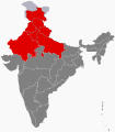
File:Northwest India Map.svg
Click on a date/time to view the file as it appeared at that time.
| Date/Time | Thumbnail | Dimensions | User | Comment | |
|---|---|---|---|---|---|
| current | 17:10, 15 May 2024 |  | 512 × 583 (155 KB) | Sbb1413 | Colouring the claimed territories since there are no neighbouring countries in this map. |
| 00:32, 15 February 2017 |  | 1,574 × 1,792 (323 KB) | Tiger7253 | User created page with UploadWizard |
File usage
The following 2 pages use this file:
Global file usage
The following other wikis use this file:
- Usage on bn.wikipedia.org
- Usage on he.wikipedia.org
- Usage on hi.wikipedia.org
- Usage on id.wikipedia.org
- Usage on ka.wikipedia.org
- Usage on my.wikipedia.org
- Usage on www.wikidata.org