File:Nueva Y Correcta Carta Del Mar Pacifico ó Del Sur - Vicente De La Fuente F. - Btv1b53053066z.jpg
Español: Nueva y Correcta Carta del Mar Pacifico ó del Sur
(

 )
)
Author
Title
Description
Depicted place
Date
1744
Dimensions
height: 75 cm (29.5 in); width: 48.5 cm (19 in)
Collection
References
Source/Photographer
Permission
(Reusing this file)
Other versions
English: Vicente de la Fuente
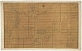
English: New and Correct Map of the Pacific or Southern Ocean
Español: Nueva y Correcta Carta del Mar Pacifico ó del Sur
English: A map of the west coast of Central and South America and the Galapagos Islands, supposedly revised from the best news of Spanish pilots and most accurate astronomical and nautical observations, with Roman numerals denoting magnetic variation. Inset maps of Joachim Darquistade's St Francis Bay (Baie de St.-François) from his 1715 survey.
Español: Nueva y correcta carta del Mar Pacifico ó del Sur construida por las mejores noticias de los pilotos de ella y las mas exactas observaciones astronomicas y nauticas el año de 1744 las cifras romanas denotan la variacion de la aguja NC. que se ha observado en el mismo parage donde se halla la cifra. Plano de la Baía de San Francisco descubierta en la Tierradel Fuego e immediato al Cabo de Hornos el año 1715 por el Capitan Joachin Darquistade con las demas ensenadas y jondeaderos que en ella hallo.
Français : Carte espagnol de l'ouest côte de l'Amérique du Sud.
English: West coast of South America
Français : Amérique du Sud. Ouest. Côtes.
| Bibliothèque nationale de France
|
|||
|---|---|---|---|
 |
|||
| Native name | Bibliothèque nationale de France | ||
| Parent institution | Ministry of Culture of France | ||
| Location | |||
| Coordinates | 48° 50′ 01″ N, 2° 22′ 33″ E | ||
| Established | 1368 | ||
| Website | www.bnf.fr/en | ||
| Authority file | |||
Français : Notice de recueil : http://catalogue.bnf.fr/ark:/12148/cb40577015h
Appartient à : Collection d'Anville ; 09173 B
Notice du catalogue : http://catalogue.bnf.fr/ark:/12148/cb406071772Français : Bibliothèque nationale de France, département Cartes et plans, GE DD-2987 (9173 B)
Bibliothèque nationale de France
(Reusing this file)
Previous public domain rationale, no longer applicable
| ||
|---|---|---|
|
-
 Detail of the Galapagos Islands
 -
 1748 ms.
 -
 1748 ed.


te_de_la_Fuente_f._-_btv1b531233099.jpg)
| Annotations | This image is annotated: View the annotations at Commons |
