File:Offa Dioceses.gif
Own work using:
Author
w:en:User:Mike Christie
- Created using DMIS. On that site it is stated that "We do not claim copyright on the images, so you can use them for Wikipedia."
- Map in Patrick Wormald's "The Age of Bede and Aethelbald", in James Campbell et al., The Anglo-Saxons, p. 71.
The original upload says
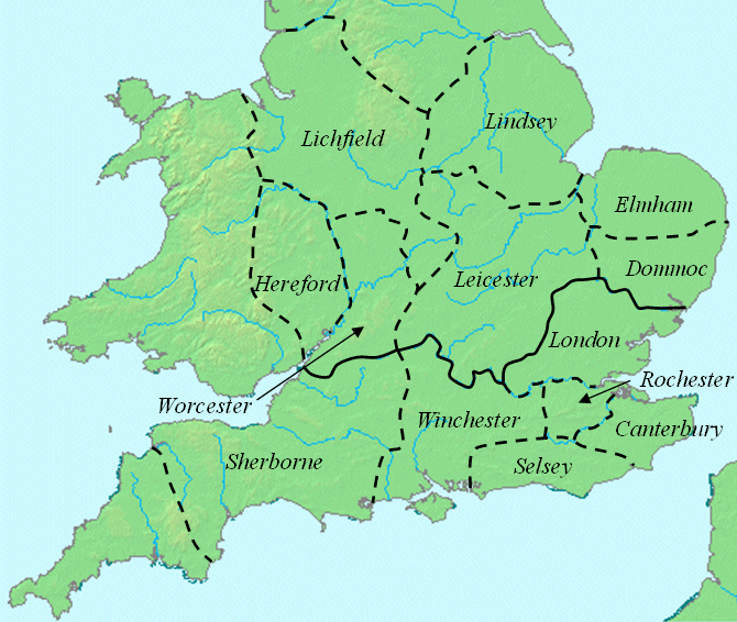
- current 16:51, 6 January 2008 w:en:User:Mike Christie (Talk | contribs) 670×566 174 KB This map shows dioceses in England during the reign of Offa. The boundary between the archdioceses of Lichfield and Canterbury is shown in bold. This file was created using DMIS archive copy at the Wayback Machine. On that site it is [http://supp
| |
This work has been released into the public domain by its author, Mike Christie, at the English Wikipedia project. This applies worldwide. In case this is not legally possible: |