This tag is designed for use where there may be a need to assert that any enhancements (eg brightness, contrast, colour-matching, sharpening) are in themselves insufficiently creative to generate a new copyright. It can be used where it is unknown whether any enhancements have been made, as well as when the enhancements are clear but insufficient. For known raw unenhanced scans you can use an appropriate {{PD-old}} tag instead. For usage, see Commons:When to use the PD-scan tag.
Note: This tag applies to scans and photocopies only. For photographs of public domain originals taken from afar, {{PD-Art}} may be applicable. See Commons:When to use the PD-Art tag.
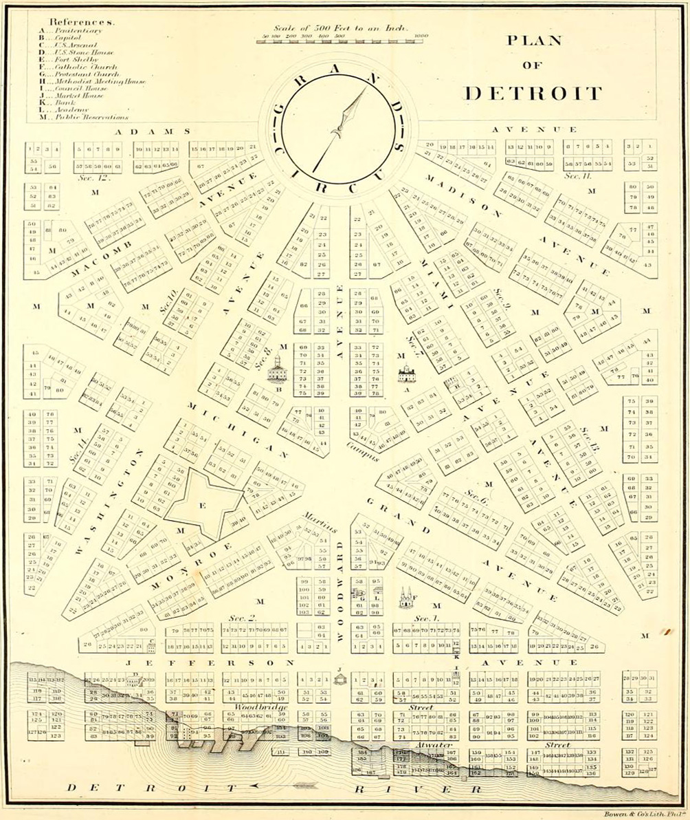
== Summary == Detroit city layout circa 1807 following the 1805 fire that destroyed most of the city. From the Detroit Historical Museum site == Licensing == {{PD-US}} Category:Michigan mapsCategory:Images of Detroit, Michigan [[Category:Images


