File:Orange County Watershed Map.png
Click on a date/time to view the file as it appeared at that time.
| Date/Time | Thumbnail | Dimensions | User | Comment | |
|---|---|---|---|---|---|
| current | 22:22, 14 March 2016 | 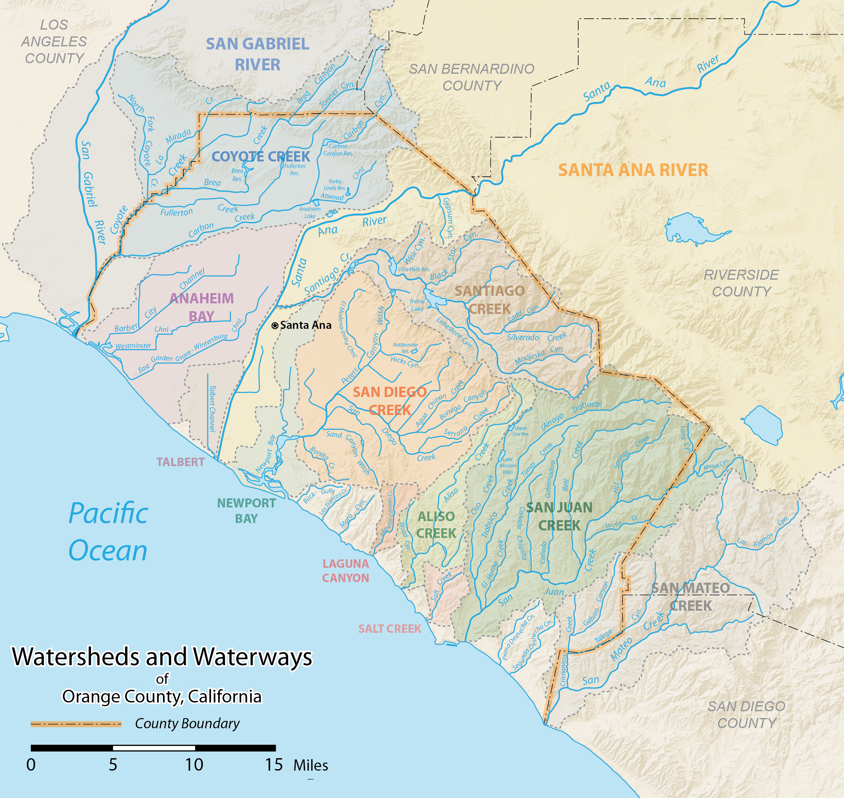 | 2,712 × 2,565 (4.99 MB) | Shannon1 | {{Information |Description ={{en|1=Map of Orange County, California showing the major watersheds, rivers and streams. Made using data from the USGS and the County of Orange.}} |Source =Own work |Author =Shannon1 |Da... |
File usage
The following pages on the English Wikipedia use this file (pages on other projects are not listed):
Global file usage
The following other wikis use this file:
- Usage on ban.wikipedia.org