File:Oude Tonge 1866.png
Click on a date/time to view the file as it appeared at that time.
| Date/Time | Thumbnail | Dimensions | User | Comment | |
|---|---|---|---|---|---|
| current | 14:23, 23 May 2007 | 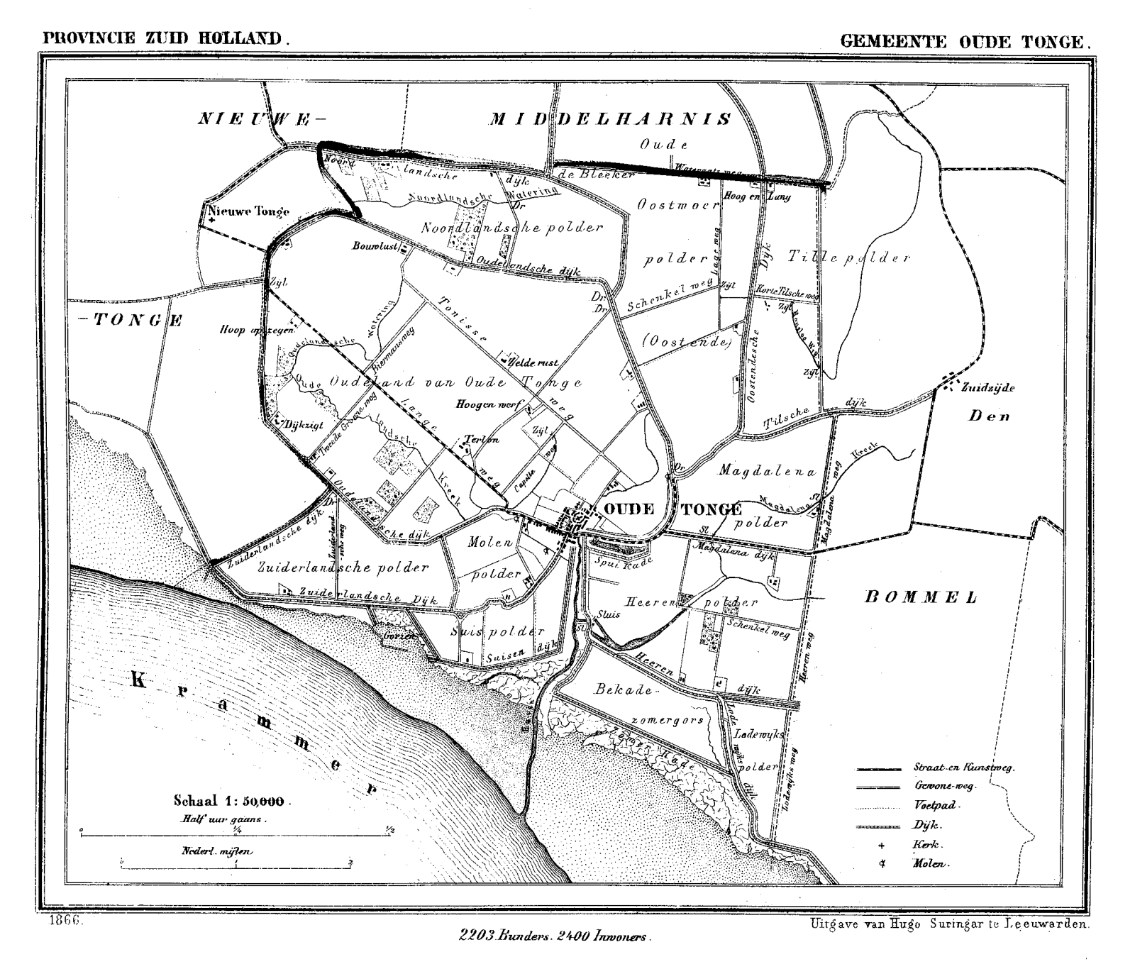 | 1,600 × 1,366 (220 KB) | P199 | {{Information |Description=Historic map of Oude Tonge (now part of municipality Oostflakkee), South Holland, the Netherlands |Source=Gemeente Atlas van Nederland (Municipal Atlas of the Netherlands) |Date=1865-1870 |Author=J. Kuyper |Permission= |other_ve |
File usage
The following pages on the English Wikipedia use this file (pages on other projects are not listed):
Global file usage
The following other wikis use this file:
- Usage on id.wikipedia.org
- Usage on pt.wikipedia.org
- Usage on vi.wikipedia.org
- Usage on zh.wikipedia.org