File:PIA18780-MarsCuriosityRover-HIRISE-PlannedRouteMap-PahrumpHills-MountSharp-20140911.jpg
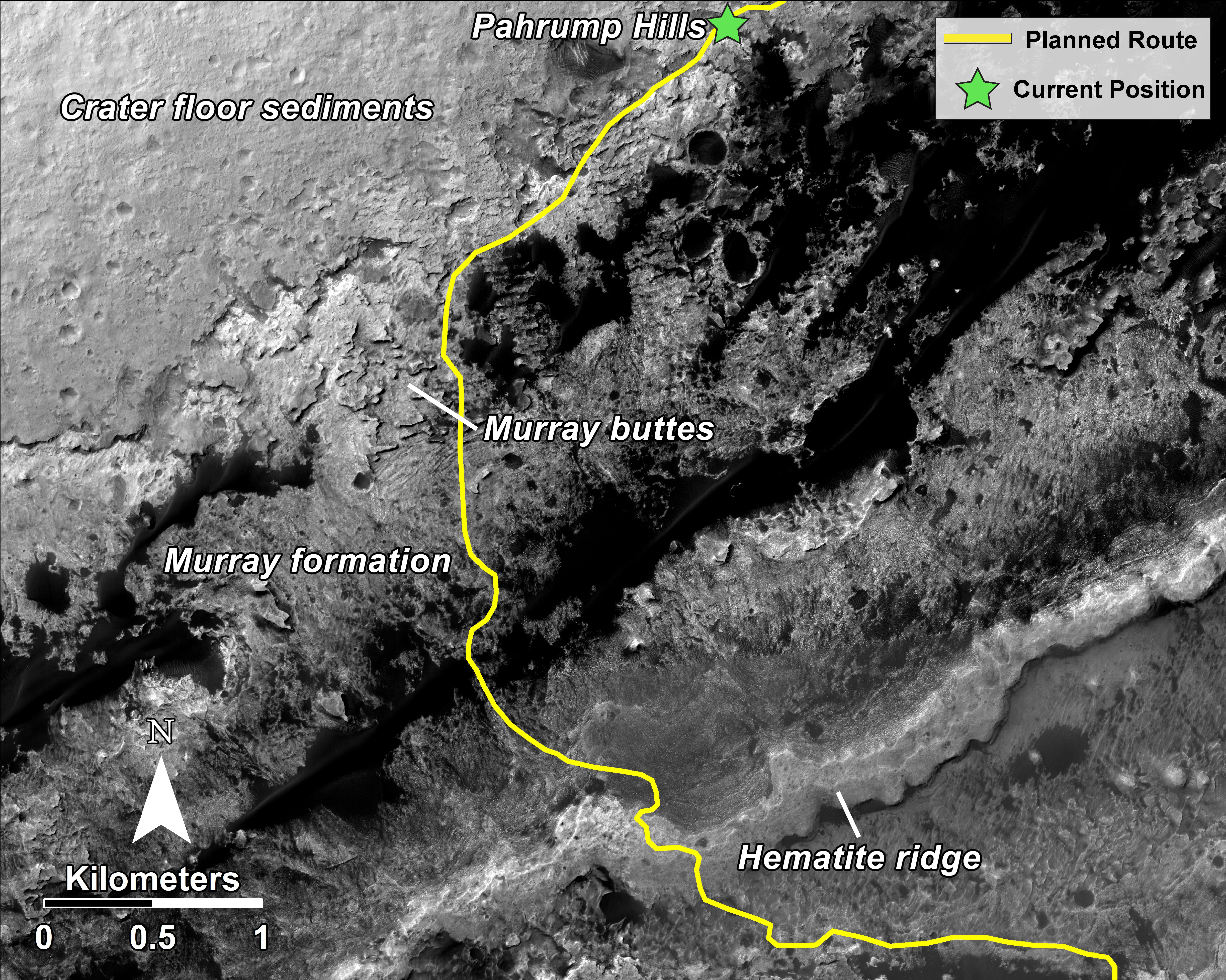
This mosaic, taken with the High Resolution Imaging Science Experiment (HiRISE) camera on NASA's Mars Reconnaissance Orbiter, shows the planned route (in yellow) of NASA's Curiosity rover from "Pahrump Hills" at the base of Mount Sharp, through the "Murray Formation," and south to the hematite ridge further up the flank of Mount Sharp.
HiRISE is one of six instruments on NASA's Mars Reconnaissance Orbiter. The University of Arizona, Tucson, operates HiRISE, which was built by Ball Aerospace & Technologies Corp., Boulder, Colorado. NASA's Jet Propulsion Laboratory, a division of the California Institute of Technology in Pasadena, manages the Mars Reconnaissance Orbiter and Mars Science Laboratory projects for NASA's Science Mission Directorate, Washington.
Polski: Planowana trasa łazika Curiosity
Ta mozaika, złożona ze zdjęć wykonanych przez kamerę High Resolution Imaging Science Experiment (HiRISE) zamontowanej na należącym do NASA orbiterze Mars Reconnaissance Orbiter, pokazuje zaplanowaną trasę (w żółtym kolorze) łazika Curiosity od "Pahrump Hills" u podstawy Mount Sharp, poprzez "Murray Formation" i dalej na południe do grzbietu hematytu na obrzeżu Mount Sharp.
HiRISE jest jednym z sześciu instrumentów zamontowanych na orbiterze Mars Reconnaissance Orbiter. Universitet z Arizony, Tucson, obsługuje HiRISE, który został zbudowany przez Ball Aerospace & Technologies Corp, Boulder, w Colorado. Należące do NASA Jet Propulsion Laboratory, oddział California Institute of Technology w Pasadenie, zarządza orbiterem Mars Reconnaissance Orbiter i łazikiem Mars Science Laboratory dla należącego do NASA dyrektoriatu Science Mission Directorate w Waszyngtonie.
