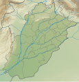
File:Pakistan Punjab Relief Map.svg
Click on a date/time to view the file as it appeared at that time.
| Date/Time | Thumbnail | Dimensions | User | Comment | |
|---|---|---|---|---|---|
| current | 21:34, 25 April 2024 |  | 849 × 1,031 (1.68 MB) | GrandEscogriffe | north-south stretching |
| 04:16, 4 October 2021 |  | 849 × 883 (1.69 MB) | C1MM | Corrected Nanakana Sahib district | |
| 03:47, 20 September 2021 |  | 849 × 883 (1.53 MB) | C1MM | Added better relief and boundaries | |
| 22:46, 24 October 2020 |  | 779 × 912 (2.23 MB) | C1MM | Fixed background image | |
| 16:30, 18 April 2020 |  | 779 × 912 (822 KB) | C1MM | Uploaded a work by Own work, derivative of Milenioscuro from Pakistan Punjab location map.svg with UploadWizard |
File usage
The following pages on the English Wikipedia use this file (pages on other projects are not listed):
- Aqsa Mosque, Rabwah
- Ayub National Park
- Battle of Jhelum (1857)
- Battle of Ramnagar
- Chhachh
- Dai Anga Mosque
- Ganweriwal
- Harappa
- Islam Headworks
- Jandial
- Kasur
- Khabikki Lake
- Kharian
- Kot Hasan Khan
- Mankiala
- Namal Lake
- PAF Base Murid
- Pothohar Plateau
- Rawal lake
- Rawalpindi
- Salt Range
- Shahi Mosque
- Shalimar Gardens, Lahore
- Sivaelurus
- Sivapardus
- Sivasmilus
- Sulemanki Headworks
- Taxila
- Tilla Jogian
- User:Unbenthatt99/Rawalpindi test
- Module:Location map/data/Pakistan Punjab
- Module:Location map/data/Pakistan Punjab/doc
- Module:Location map/data/Pakistan Punjab/sandbox
- Module:Location map/data/Punjab Pakistan
Global file usage
The following other wikis use this file:
- Usage on bn.wikipedia.org
- Usage on de.wikipedia.org
- Usage on eo.wikipedia.org
- Rawalpindi
- Harapo
- Panĝabo (Pakistano)
- Peŝavaro
- Multano
- Guĝranvalo
- Sargodha
- Moskeo Badŝahi
- Nankana Sahib
- Rahim Jar Ĥan
- Muzafargaro
- Vehari
- Ĥaneval
- Sialkot
- Ŝejĥupura
- Ĝang
- Guĝrat
- Kasur
- Vah (urbo)
- Sahival
- Okara
- Kamoke
- Ĉiniot
- Burevala
- Mandi Bahaudin
- Hafizabad
- Ĝelum (urbo)
- Pakpatan
- Muridke
- Ĥanpur
- Goĝra
- Daska
- Samundri
- Ĝaranvala
- Ĉiŝtian
- Atok (Pakistano)
- Kot Abdul Malik
- Ferozevala
- Orienta Ahmedpur
- Kamalia
- Kot Adu
- Ĥuŝab
- Ĉakval
- Vazirabad
View more global usage of this file.