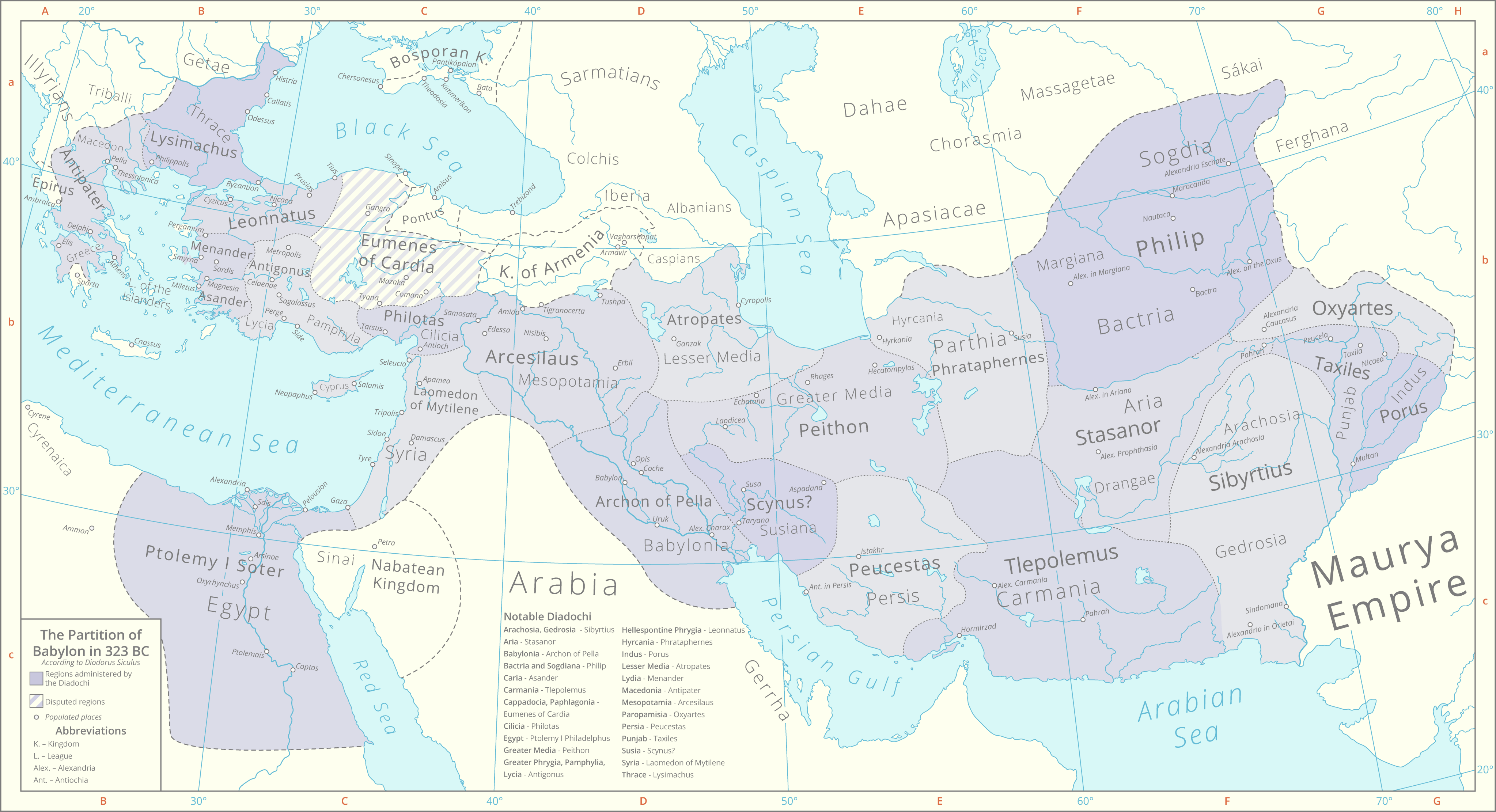
File:Partition Of Babylon 323 BC.png
Historical lakes and coastlines are derived from the Ancient World Mapping Center [1].
The boundaries of the peripheral kingdoms are based on these maps File:Bosporan Kingdom growth map-en.svg File:Hellenistic world and Maurya Empire 281 BCE.png
