File:Pecosmap.png
Click on a date/time to view the file as it appeared at that time.
| Date/Time | Thumbnail | Dimensions | User | Comment | |
|---|---|---|---|---|---|
| current | 02:37, 31 March 2016 | 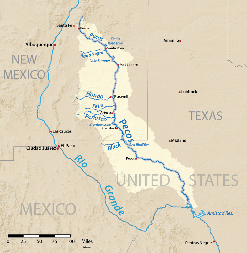 | 864 × 888 (860 KB) | Shannon1 | {{Information |Description ={{en|1=Map of the watershed of Pecos River, a tributary of the Rio Grande, in New Mexico and Texas, USA. Made using USGS National Map data.}} |Source =Own work |Author =Shannon1 |Date... |
File usage
The following pages on the English Wikipedia use this file (pages on other projects are not listed):
Global file usage
The following other wikis use this file:
- Usage on af.wikipedia.org
- Usage on bg.wikipedia.org
- Usage on el.wikipedia.org
- Usage on fa.wikipedia.org
- Usage on fy.wikipedia.org
- Usage on ja.wikipedia.org
- Usage on oc.wikipedia.org
- Usage on sk.wikipedia.org
- Usage on sv.wikipedia.org
- Usage on xmf.wikipedia.org
- Usage on zh.wikipedia.org