File:Penang Harbour HMS Magpie 1884 Penang Map.jpg
This work is in the
public domain in its country of origin and other countries and areas where the
copyright term is the author's
life plus 100 years or fewer.
 You must also include a United States public domain tag to indicate why this work is in the public domain in the United States.
| This file has been identified as being free of known restrictions under copyright law, including all related and neighboring rights.
|
https://creativecommons.org/publicdomain/mark/1.0/PDMCreative Commons Public Domain Mark 1.0falsefalse
Click on a date/time to view the file as it appeared at that time.
| Date/Time | Thumbnail | Dimensions | User | Comment |
|---|
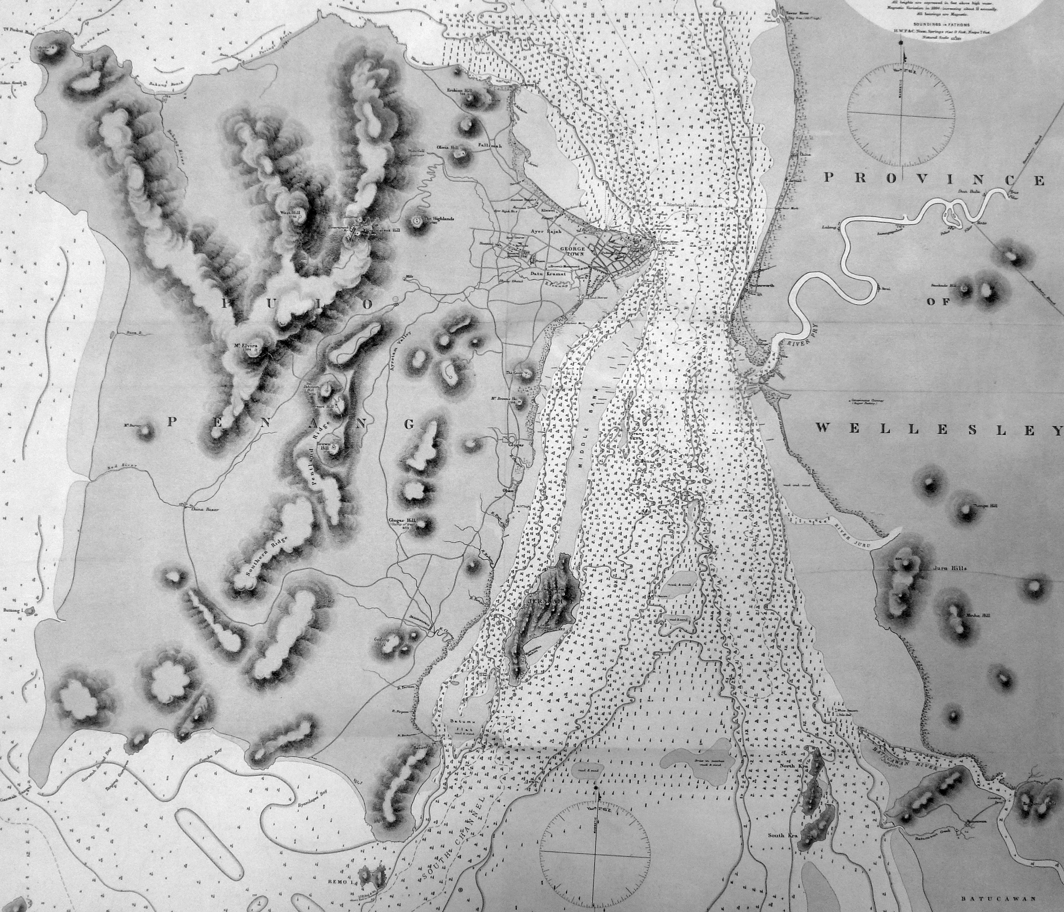
| current | 18:40, 25 November 2012 |  | 3,584 × 3,072 (2 MB) | Cmglee | {{Information |Description ={{en|1=Extract showing Penang Island and part of Province Wellesley, of the map labelled MALACCA STRAIT PULO PENANG PENANG HARBOUR Surveyed by Commander the Hon. Foley C. P. Vereker, R. N., assisted by Lieut. C. G. F... |
The following pages on the English Wikipedia use this file (pages on other projects are not listed):
The following other wikis use this file:
- Usage on fr.wikipedia.org