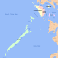
File:Ph MIMAROPA.png
Click on a date/time to view the file as it appeared at that time.
| Date/Time | Thumbnail | Dimensions | User | Comment | |
|---|---|---|---|---|---|
| current | 04:47, 26 November 2021 |  | 1,210 × 1,216 (75 KB) | Hariboneagle927 | Reverted to version as of 08:54, 30 March 2021 (UTC) |
| 03:44, 26 November 2021 |  | 3,000 × 3,234 (727 KB) | Nissan2020 | Reverted to version as of 11:15, 28 March 2021 (UTC) | |
| 08:54, 30 March 2021 |  | 1,210 × 1,216 (75 KB) | HueMan1 | Reverted to version as of 15:35, 14 May 2020 (UTC) | |
| 11:15, 28 March 2021 |  | 3,000 × 3,234 (727 KB) | Teamayuiyui | Update from 2021 | |
| 15:35, 14 May 2020 |  | 1,210 × 1,216 (75 KB) | HueMan1 | Reverted to version as of 07:24, 31 December 2009 (UTC) | |
| 21:45, 11 May 2020 |  | 1,210 × 1,216 (228 KB) | Yuiyui2014 | 5 Provinces | |
| 07:24, 31 December 2009 |  | 1,210 × 1,216 (75 KB) | Urdangaray | {{Information |Description={{en|Political map of MIMAROPA Region, en:Philippines. Showing en:Marinduque, en:Occidental Mindoro, en:Oriental Mindoro, en:Palawan and en:Romblon. Used the map template [[:e |
File usage
The following page uses this file:
Global file usage
The following other wikis use this file:
- Usage on bcl.wikipedia.org
- Usage on bn.wikipedia.org
- Usage on cbk-zam.wikipedia.org
- Usage on ceb.wikipedia.org
- Usage on de.wikipedia.org
- Usage on es.wikipedia.org
- Usage on lv.wikipedia.org
- Usage on nl.wikipedia.org
- Usage on pam.wikipedia.org
- Usage on pl.wikipedia.org
- Usage on simple.wikipedia.org
- Usage on tl.wikipedia.org
- Usage on vi.wikipedia.org
- Usage on war.wikipedia.org