File:Pittsburgh-1828.jpg
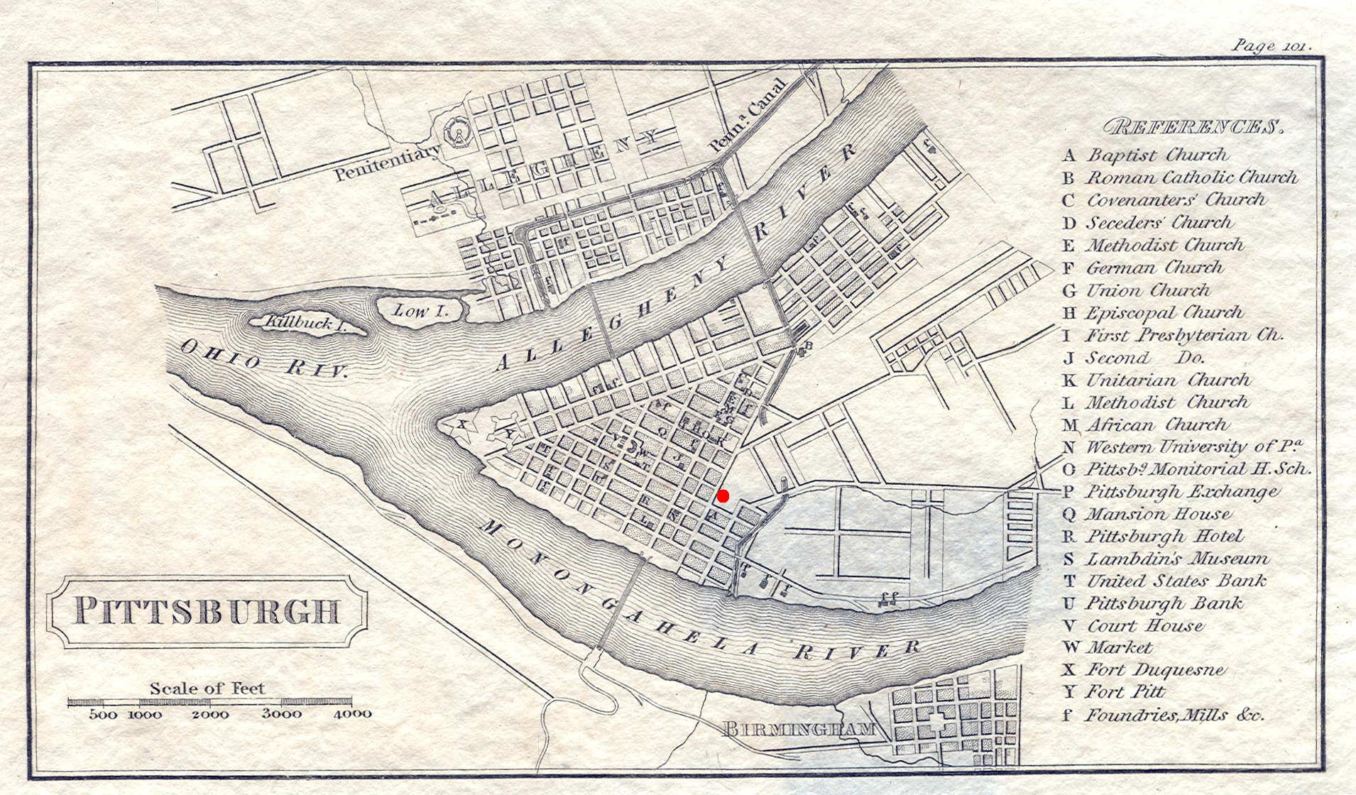
PITTSBURGH, page 101 from View of the United States, Historical, Geographical, and Statistical..., by William Darby, Philadelphia: published by H. S. Tanner 1828. This small map of downtown Pittsburgh includes part of the north (then Allegheny) and south (then Birmingham) shores. The Pennsylvania Canal and the Penitentiary are named. There is a table on the right with letters locating points of interest within the city. The courthouse location of the time is given by the letter "V" on what is now Market Square. Today's courthouse lies near the red dot on what was then called Grant's Hill.
Licensing
|
This work is in the public domain in its country of origin and other countries and areas where the copyright term is the author's life plus 70 years or fewer. | |
| This file has been identified as being free of known restrictions under copyright law, including all related and neighboring rights. | |