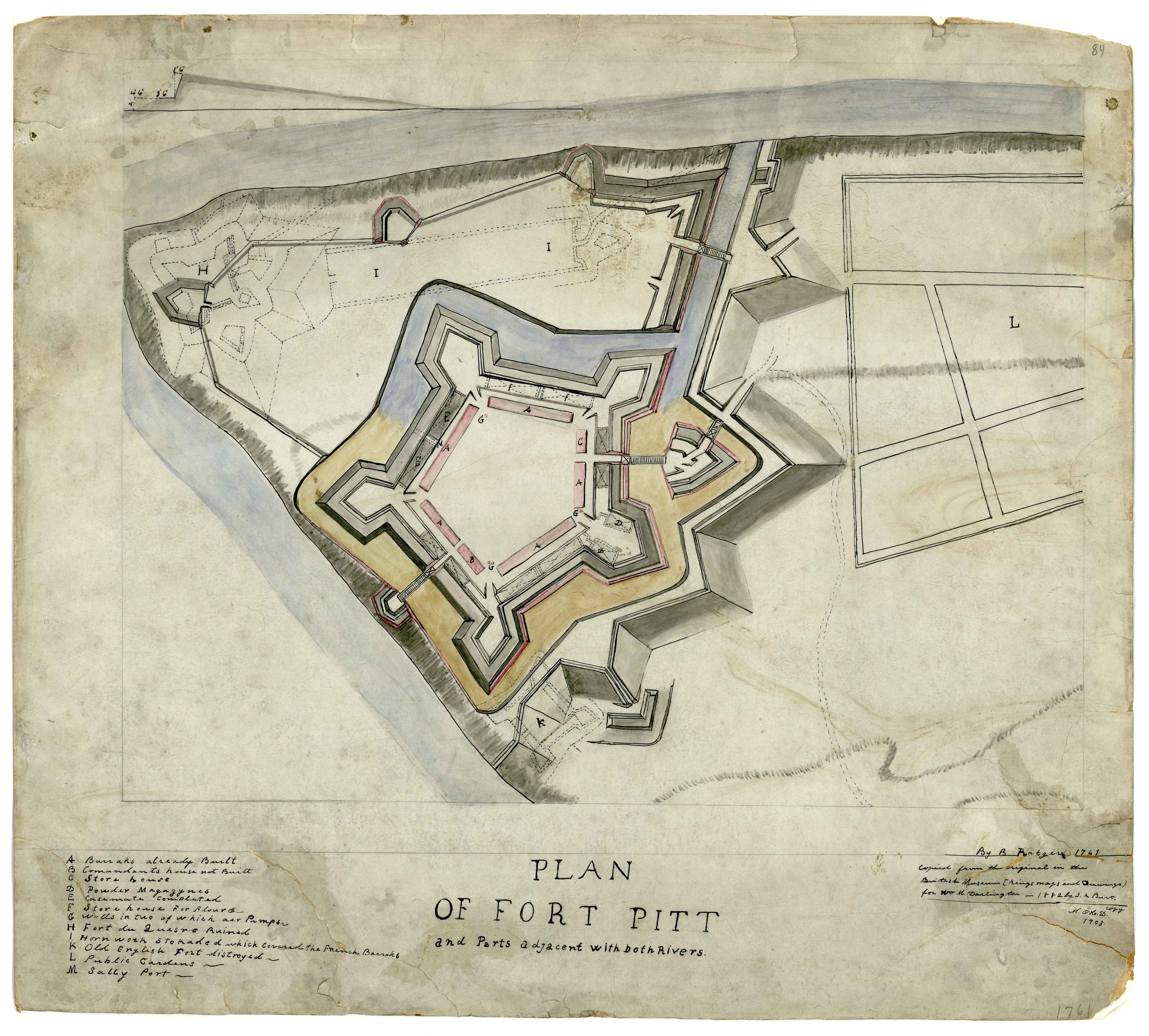
File:Plan Of Fort Pitt, 1761.jpg
Title: Plan of Fort Pitt and parts adjacent …
Date: 1761
Creator: Ratzer, Bernard.
Description: Plan of Fort Pitt and parts adjacent with both rivers.
Manuscript Map. Copied from the orginial in the British Library (Kings' maps and drawings) for Wm. Darlington by J. A. Burt, 1882. M. O'H. D. copy 1903.
Also showing, in dotted line, the earlier French Fort Duquesne.
Subjects: Fort Pitt (Pa.)--Maps, Manuscript.; Fort Duquesne (Pa.)--Maps, Manuscript.; Pennsylvania--Maps, Manuscript.; United States--History--French and Indian War, 1755-1763--Maps, Manuscript.; Allegheny County (Pa.)--Maps, maunscript.; Maps, Manuscript.; Burt, J
Dimension: 50 x 56 cm
Scale: 1:3,050
Identifier: DARMAP0213
| Bernard Ratzer
(1700–) |
|||
|---|---|---|---|
| Alternative names |
Bernard Ratzen | ||
| Description | British cartographer and surveyor | ||
| Date of birth |
1700 | ||
| Work period | 1756–84 | ||
| Work location |
New York region | ||
| Authority file | |||

