File:Plat Of Barnum - DPLA - 8a432735b6fa9dcbfe14c8c55c75e2ce.jpg
Note: this data is being maintained by an automated bot, synced with the source data.
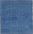
| Description | Blueprint map showing boundaries of plots, land owners for larger areas, stret names, and neighborhood additions. | ||||||||||||||||||||
| Title | Plat of Barnum | ||||||||||||||||||||
| Institution |
|
||||||||||||||||||||
| Subject | |||||||||||||||||||||
| Source |
Plains to Peaks Collective |
||||||||||||||||||||
| Author | |||||||||||||||||||||
| Permission (Reusing this file) |
|||||||||||||||||||||
| Partnership |
|
||||||||||||||||||||


