File:Plate Tectonics Map.gif
Digital Tectonic Activity Map of the Earth (DTAM):
Tectonism and Volcanism of the Last One Million Years
Tectonism and Volcanism of the Last One Million Years
| This file is in the public domain in the United States because it was solely created by NASA. NASA copyright policy states that "NASA material is not protected by copyright unless noted". (See Template:PD-USGov, NASA copyright policy page or JPL Image Use Policy.) | ||
 |
Warnings:
|
Click on a date/time to view the file as it appeared at that time.
| Date/Time | Thumbnail | Dimensions | User | Comment | |
|---|---|---|---|---|---|
| current | 09:41, 26 August 2017 | 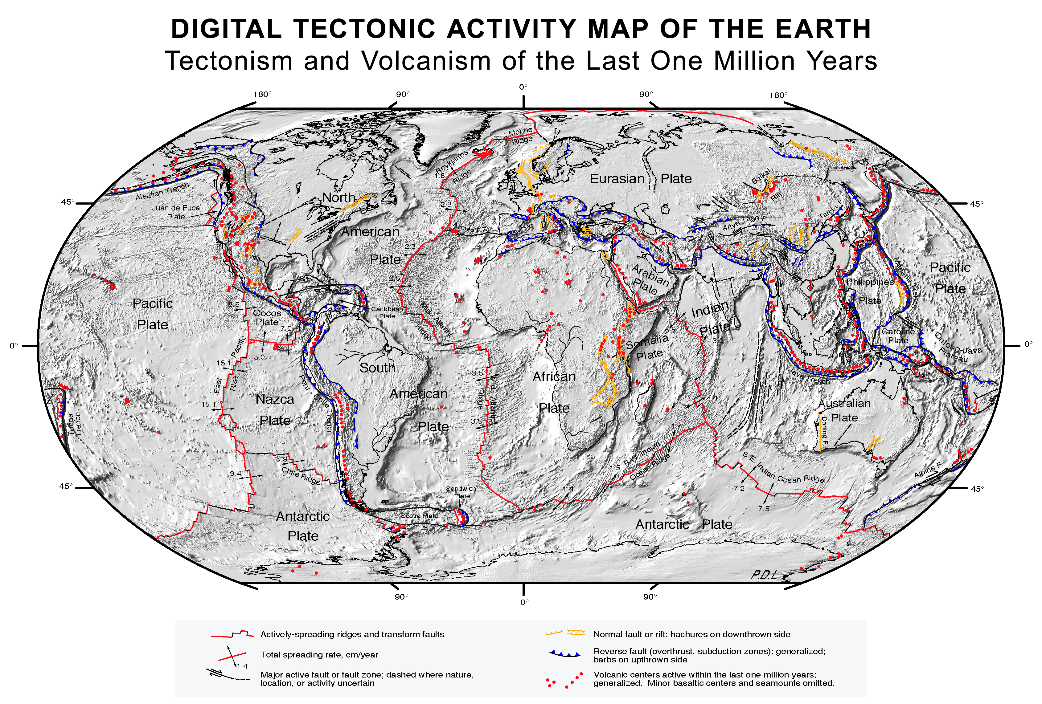 | 3,380 × 2,285 (2.63 MB) | Nagualdesign | White background. |
| 09:20, 26 August 2017 |  | 3,380 × 2,285 (2.63 MB) | Nagualdesign | Minor correction. | |
| 09:16, 26 August 2017 |  | 3,380 × 2,285 (2.63 MB) | Nagualdesign | Rearranged elements, removed clutter. | |
| 10:52, 16 April 2011 |  | 3,577 × 2,313 (2.68 MB) | Michael Metzger | uploaded a new version of this file with much higher resolution | |
| 12:08, 8 October 2007 |  | 1,280 × 838 (359 KB) | Geni | rmed nasa logo | |
| 03:19, 17 February 2005 |  | 1,280 × 838 (360 KB) | Quadell | Plate Tectonics map ([http://epod.usra.edu/archive/epodviewer.php3?oid=39392 source]){{PD-USGov-NASA}}Category:World mapsCategory:Plate tectonicsCategory:Continental drift |
More than 100 pages use this file. The following list shows the first 100 pages that use this file only. A full list is available.
View more links to this file.
The following other wikis use this file:
View more global usage of this file.