File:Political Map Of The Levant, Circa 1085.png
Click on a date/time to view the file as it appeared at that time.
| Date/Time | Thumbnail | Dimensions | User | Comment | |
|---|---|---|---|---|---|
| current | 22:06, 24 November 2020 | 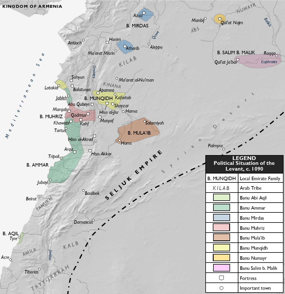 | 991 × 1,020 (547 KB) | Al Ameer son | Correct placement of the Kilab |
| 21:54, 24 November 2020 |  | 991 × 1,020 (548 KB) | Al Ameer son | Add Banu Mirdas of Azaz and Atharib, Bani Abi Aqil of Tyre, change date to 1090, minor changes | |
| 20:22, 19 November 2020 |  | 987 × 1,013 (540 KB) | Al Ameer son | Fix error (Banu Muhriz name) | |
| 20:15, 19 November 2020 |  | 987 × 1,013 (539 KB) | Al Ameer son | Expand Banu Ammar territory to span Tartus and Arqa | |
| 18:49, 19 November 2020 |  | 986 × 1,012 (538 KB) | Al Ameer son | Expand Banu Ammar territory to include Khawabi | |
| 17:14, 19 November 2020 |  | 987 × 1,017 (538 KB) | Al Ameer son | Rmv bold from emirate names | |
| 17:04, 19 November 2020 |  | 987 × 1,015 (536 KB) | Al Ameer son | Cropped, enlarged script, other modifications | |
| 22:36, 18 November 2020 |  | 1,213 × 1,265 (695 KB) | Al Ameer son | Uploaded own work with UploadWizard |
File usage
The following pages on the English Wikipedia use this file (pages on other projects are not listed):
Global file usage
The following other wikis use this file:
- Usage on fa.wikipedia.org
- Usage on pt.wikipedia.org