Click on a date/time to view the file as it appeared at that time.
| Date/Time | Thumbnail | Dimensions | User | Comment |
|---|
| current | 04:33, 30 January 2010 | 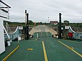 | 640 × 480 (100 KB) | GeographBot | == {{int:filedesc}} == {{Information |description={{en|1=Portavadie to Tarbert ferry. Sorry did not get chance for a picture from the shore because the ferry was just about to leave!}} |date=2005-06-29 |source=From [http://www.geograph.org.uk/photo/22830 |
The following page uses this file:
The following other wikis use this file:
- Usage on www.wikidata.org
This file contains additional information, probably added from the digital camera or scanner used to create or digitize it.
If the file has been modified from its original state, some details may not fully reflect the modified file.
