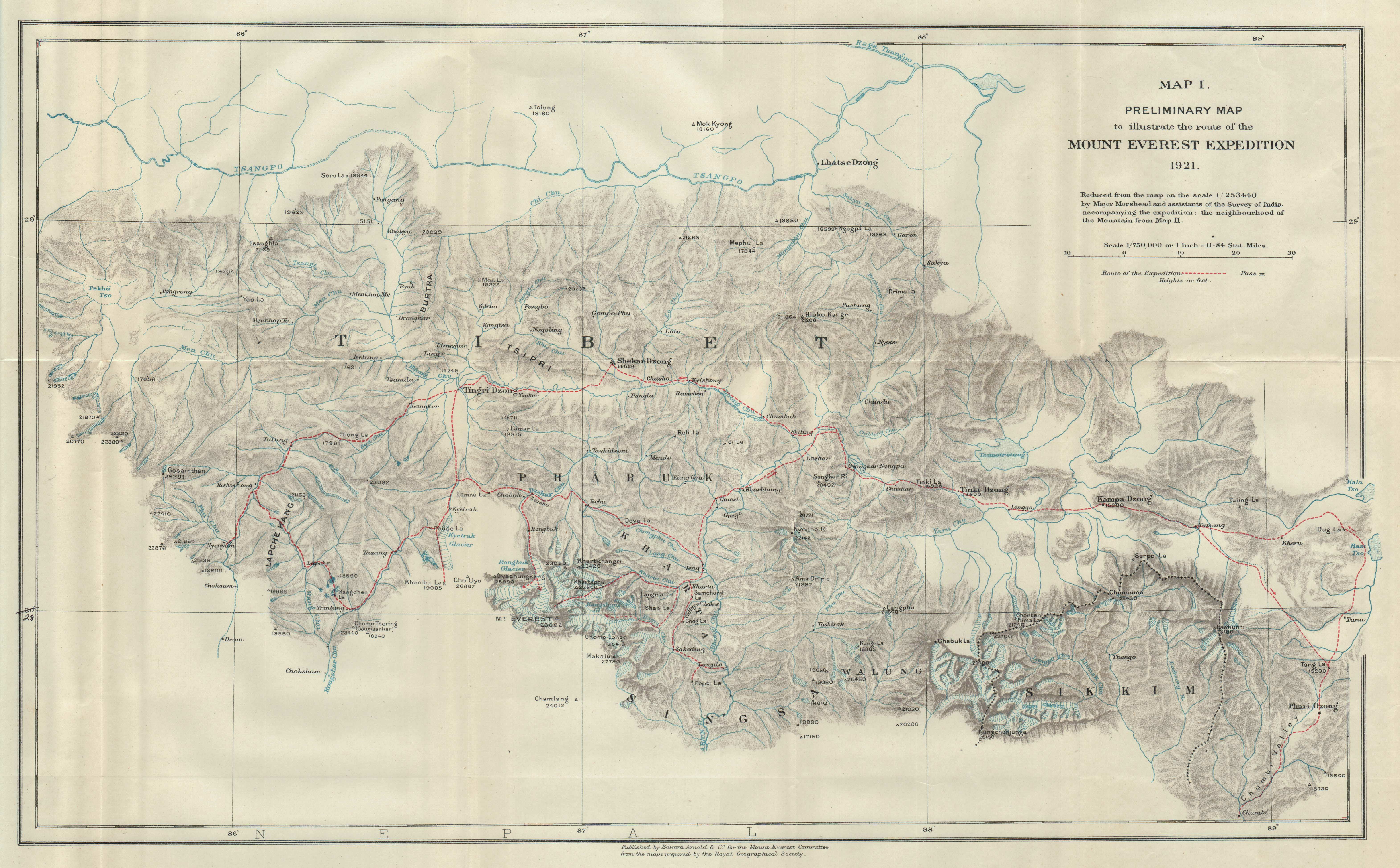
File:Preliminary Map Of Mount Everest Expedition, 1921. Map I.jpg
Original publication: New York
Immediate source: http://pahar.in/mountains/1921-route-of-mount-everest-expedition-by-everest-committee-jpg/
Creator
Geotemporal data
Bounding box
Georeferencing
Other versions
Immediate source: http://pahar.in/mountains/1921-route-of-mount-everest-expedition-by-everest-committee-jpg/
Henry Treise Morshead
| N: 29.5862571°N | ||
| W: 85.3050107°E | E: 89.3890319°E | |
| S: 27.333613°N | ||
.jpg)
.jpg)
.jpg)
Licensing
|
The author died in 1931, so this work is in the public domain in its country of origin and other countries and areas where the copyright term is the author's life plus 80 years or fewer. This work is in the public domain in the United States because it was published (or registered with the U.S. Copyright Office) before January 1, 1929. | |
| This file has been identified as being free of known restrictions under copyright law, including all related and neighboring rights. | |
Original upload log
The original description page was here. All following user names refer to en.wikipedia.
- 2014-06-15 10:49 Thincat 6284×3900× (2323682 bytes) New source http://pahar.in/mountains/1921-route-of-mount-everest-expedition-by-everest-committee-jpg/
- 2014-06-15 09:21 Thincat 2000×1224× (363837 bytes) Another attempt at improved image
- 2014-06-14 21:12 Thincat 1200×735× (689148 bytes) Reverted to version as of 03:31, 14 June 2014. Looks nicer but poorer resolution
- 2014-06-14 20:25 Thincat 544×333× (56512 bytes) Better image from another sourse: http://www.codex99.com/cartography/47.html
- 2014-06-14 03:31 Thincat 1200×735× (689148 bytes) Uploading an old public-domain work using [[Wikipedia:File_Upload_Wizard|File Upload Wizard]]


