File:Princess Elizabeth Land Stub Map.png
Click on a date/time to view the file as it appeared at that time.
| Date/Time | Thumbnail | Dimensions | User | Comment | |
|---|---|---|---|---|---|
| current | 07:06, 9 July 2011 | 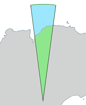 | 275 × 334 (21 KB) | Grutness | Outline map of Princess Elizabeth Land, Antarctica. Generated from File:Antarctica,_territorial_claims.svg ({{cc-by-sa-2.5|Lokal_Profil}}) by myself (User:Grutness) |
File usage
More than 100 pages use this file. The following list shows the first 100 pages that use this file only. A full list is available.
- American Highland
- Anchorage Island, Princess Elizabeth Land
- Anchorage Patch
- Barratt Island
- Barrier Bay
- Black Nunataks
- Blundell Peak
- Bode Nunataks
- Boyd Nunatak
- Branstetter Rocks
- Brattstrand Bluffs
- Braunsteffer Lake
- Breidnes Peninsula
- Browns Glacier
- Bryse Peaks
- Bølingen Islands
- Chaos Glacier
- Cleft Island (Antarctica)
- Club Lake
- Collerson Lake
- Cooke Peak
- Cowell Island
- Davey Nunataks
- Davis Anchorage
- Debutante Island
- Dingle Lake
- Dodd Island
- Dålk Glacier
- Dålk Island
- Ellis Fjord
- Filla Island
- Flatnes Ice Tongue
- Flutter Island
- Gale Escarpment
- Gardner Island
- Grove Mountains
- Hamilton Bluff
- Hamm Peak
- Holder Peak
- Il Polo Glacier
- Ingrid Christensen Coast
- Krat Rocks
- Kreitzer Glacier
- Krok Fjord
- Krok Lake
- Lake Jabs
- Lake Zvezda
- Larsemann Hills
- Leopold and Astrid Coast
- Leskov Island (Antarctica)
- Manning Island
- Mikhaylov Island
- Mount Brown (Antarctica)
- Mount Caroline Mikkelsen
- Mount Harding
- Mule Island
- Mule Peninsula
- Newman Shoal
- O'Gorman Rocks
- Oldroyd Island
- Palmer Point
- Parker Hill
- Partizan Island
- Peterson Icefalls
- Pionerskiy Dome
- Plog Island
- Polar Record Glacier
- Polar Times Glacier
- Polarforschung Glacier
- Polarårboken Glacier
- Progress Station
- Prydz Bay
- Publications Ice Shelf
- Sansom Islands
- Stevenson Glacier
- Stinear Lake
- Stornes Peninsula
- Strover Peak
- Suter Island
- Svarthausen Nunatak
- Svenner Islands
- Trajer Ridge
- Trigwell Island
- Truman Nunatak
- Tryne Bay
- Tryne Crossing
- Tryne Fjord
- Tryne Islands
- Tryne Sound
- Turner Island (Antarctica)
- Vrana Dome
- Vukovich Peaks
- Walkabout Rocks
- Warriner Island
- Watts Nunatak
- Weddell Arm
- Whisnant Nunatak
- Wilson Ridge
- Wyatt Earp Islands
- Young Peak
View more links to this file.