File:Puertogalera Chart 4344 1917.jpeg
Credits From the Image Archives of the Historical Map & Chart Collection archive copy at the Wayback Machine
Licensing
Public domain Public domain false false
English Add a one-line explanation of what this file represents
Click on a date/time to view the file as it appeared at that time.
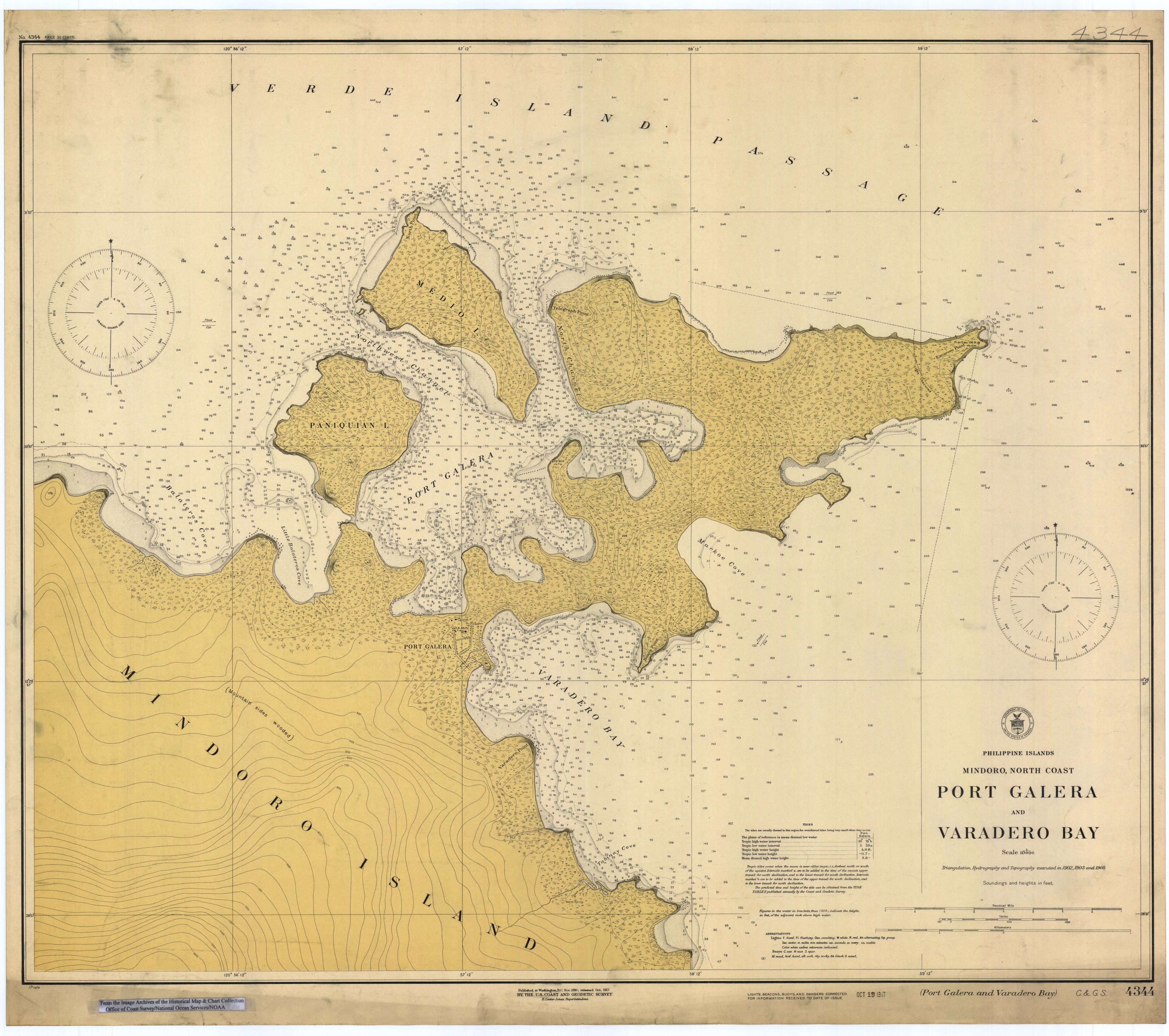
Date/Time Thumbnail Dimensions User Comment current 01:51, 17 March 2006 3,626 × 3,213 (1.69 MB) Cdc~commonswiki Scanned image of US Coast & Geodetic Survey (Manila Office) nautical chart #4344 Port Galera (Puerto Galera) and Varadero Bay, Mindoro, Philippines, 1917. From the Image Archives of the [http://chartmaker.ncd.noaa.gov/csdl/ctp/abstract.htm Historical Ma
The following page uses this file:
The following other wikis use this file:
Usage on id.wikipedia.org
Usage on pam.wikipedia.org
Usage on sv.wikipedia.org
Usage on zh.wikipedia.org
This file contains additional information, probably added from the digital camera or scanner used to create or digitize it.
If the file has been modified from its original state, some details may not fully reflect the modified file.