File history
Click on a date/time to view the file as it appeared at that time.
| Date/Time | Thumbnail | Dimensions | User | Comment | |
|---|---|---|---|---|---|
| current | 01:41, 17 March 2006 | 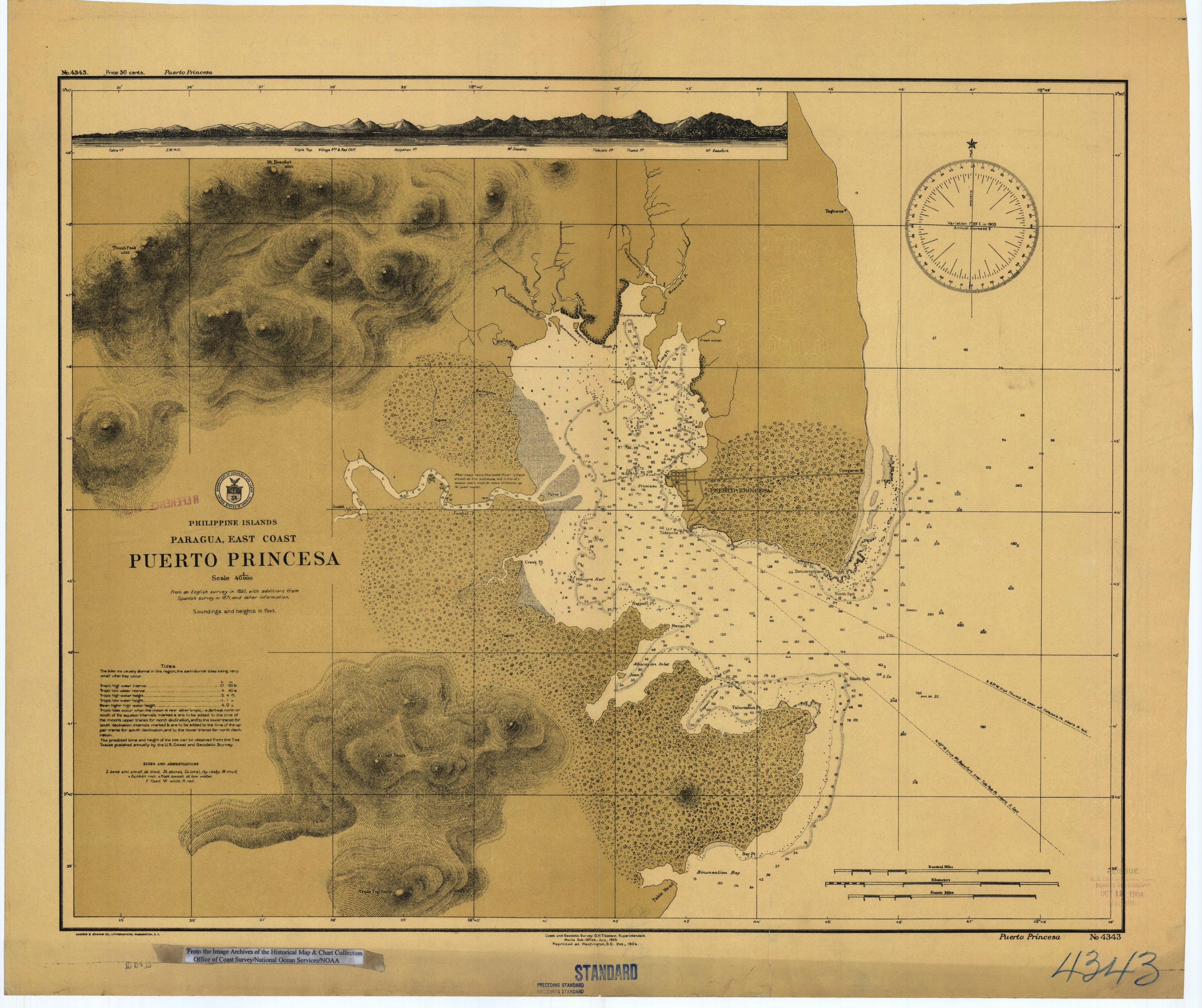 | 3,053 × 2,561 (1.31 MB) | Cdc~commonswiki | Scanned image of US Coast & Geodetic Survey (Manila Office) nautical chart #4343 Puerto Princesa, (Paragua), Palawan, Philippines, 1904. From the Image Archives of the [http://chartmaker.ncd.noaa.gov/csdl/ctp/abstract.htm Historical Map & Chart Collecti |
File usage
The following pages on the English Wikipedia use this file (pages on other projects are not listed):
Global file usage
The following other wikis use this file:
- Usage on es.wikipedia.org
- Usage on ja.wikipedia.org
- Usage on ka.wikipedia.org
- Usage on ko.wikipedia.org
- Usage on pam.wikipedia.org
- Usage on pt.wikipedia.org
- Usage on tl.wikipedia.org