File:Quad Flandria.jpg
This work is in the public domain in its country of origin and other countries and areas where the copyright term is the author's life plus 100 years or fewer.
 You must also include a United States public domain tag to indicate why this work is in the public domain in the United States.
This file has been identified as being free of known restrictions under copyright law, including all related and neighboring rights.
Georeferencing
If inappropriate please set warp_status = skip to hide.
|

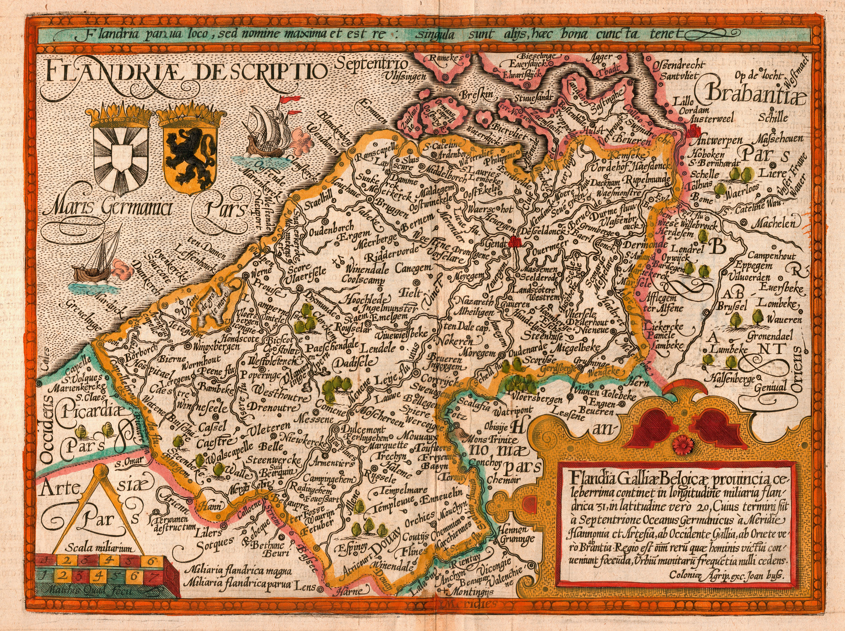
This image was selected as picture of the day on Wikimedia Commons for 6 May 2008. It was captioned as follows: English: Map of the county of Flanders by 1609 Other languages:
Alemannisch: Charte vo Flandern (Belgiä) us em Jahr 1609. Bosanski: Karta Grofovije Flandrija iz 1609. Čeština: Mapa Vévodství Flandry z roku 1609 Dansk: Kort over Flandern (Belgien) i 1609. Deutsch: Karte von Flandern (Belgien) aus dem Jahre 1609. English: Map of the county of Flanders by 1609 Français : Carte de la Flandre Íslenska: Kort af Flandri árið 1609. Italiano: Mappa delle Fiandre del 1609. Magyar: Flandria térképe 1609-ből, Matthias Quad térképész és Johannes Bussemacher grafikus és kiadó (Köln) munkája Polski: Mapa hrabstwa Flandrii wykonana około roku 1609. Svenska: Grevskapet Flandern på en karta från 1609. Türkçe: Flanders kontluğunun 1609'daki haritası Беларуская: Карта Фландрыі (1609) Русский: Карта Фландрии 1609 года Српски / srpski: Мапа Фландрије из 1609. године. Українська: Карта Фландрії 1609 року 한국어: 1609년에 그려진 플란데런 지도. 日本語: 1609年のフランドル地域の地図 中文: 佛兰德伯国1609年地图 中文(繁體): 佛蘭德伯國1609年地圖 العربية : خريطة دولة فلندرز عام 1609. فارسی : نقشه کشور فلندرز در 1609 |
