This work is in the public domain in its country of origin and other countries and areas where the copyright term is the author's life plus 70 years or fewer.
You must also include a United States public domain tag to indicate why this work is in the public domain in the United States.
Note that a few countries have copyright terms longer than 70 years: Mexico has 100 years, Jamaica has 95 years, Colombia has 80 years, and Guatemala and Samoa have 75 years. This image may not be in the public domain in these countries, which moreover do not implement the rule of the shorter term. Honduras has a general copyright term of 75 years, but it does implement the rule of the shorter term. Copyright may extend on works created by French who died for France in World War II (more information), Russians who served in the Eastern Front of World War II (known as the Great Patriotic War in Russia) and posthumously rehabilitated victims of Soviet repressions (more information).
https://creativecommons.org/publicdomain/mark/1.0/PDMCreative Commons Public Domain Mark 1.0falsefalse
This tag is designed for use where there may be a need to assert that any enhancements (eg brightness, contrast, colour-matching, sharpening) are in themselves insufficiently creative to generate a new copyright. It can be used where it is unknown whether any enhancements have been made, as well as when the enhancements are clear but insufficient. For known raw unenhanced scans you can use an appropriate {{PD-old}} tag instead. For usage, see Commons:When to use the PD-scan tag.
Note: This tag applies to scans and photocopies only. For photographs of public domain originals taken from afar, {{PD-Art}} may be applicable. See Commons:When to use the PD-Art tag.
File history
Click on a date/time to view the file as it appeared at that time.
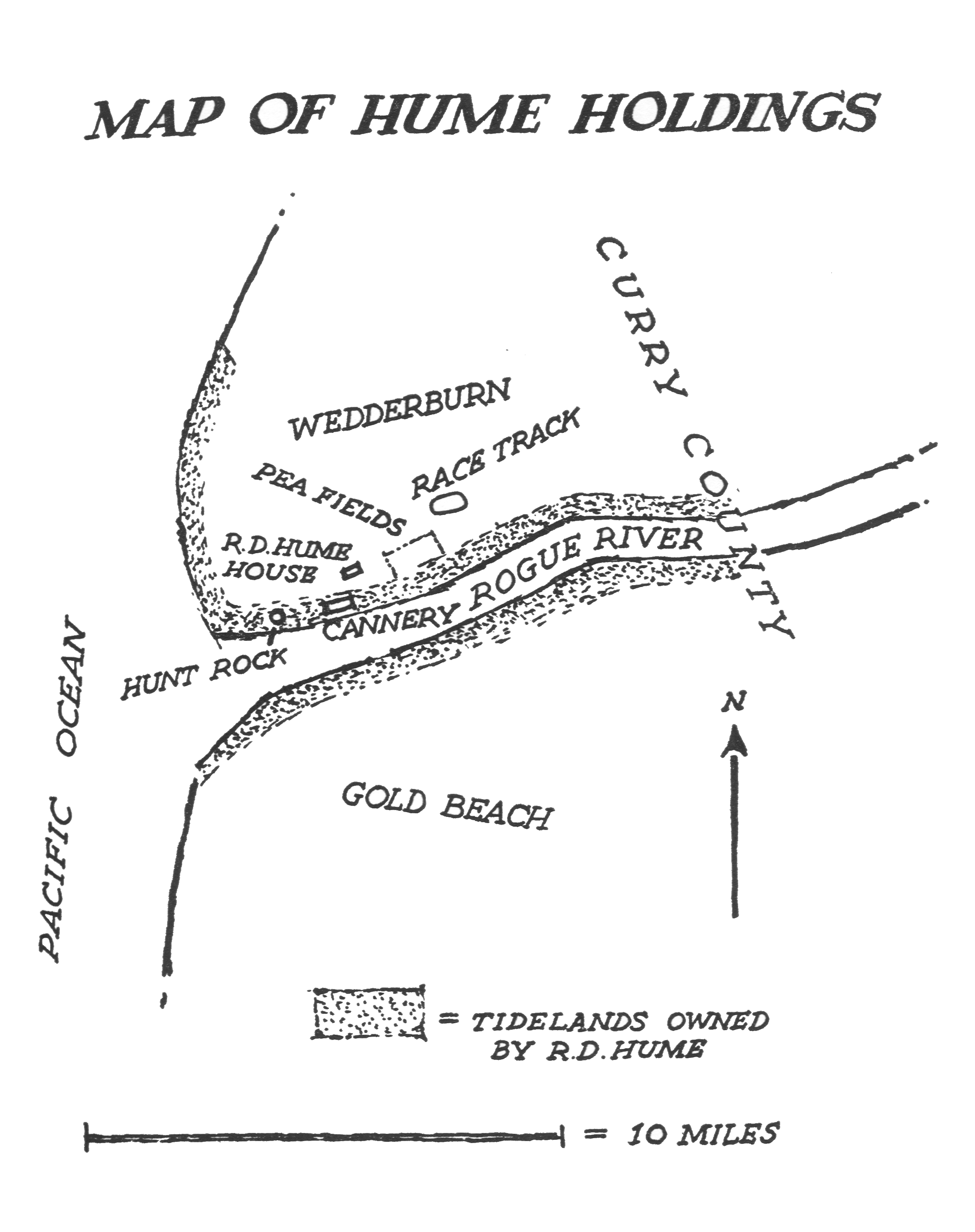
{{Information |Description={{en|1=Map of the holdings of Robert Deniston Hume along the lower Rogue River in the U.S. state of Oregon. Hume operated salmon canneries and hatcheries on the river between 1877 and 1908.}} |Source=''Salmon of the Pacific Coa
 You must also include a United States public domain tag to indicate why this work is in the public domain in the United States.