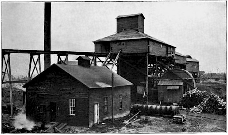
File:RelayMineNo3.jpg
location estimated from map file:CentervilleMines.png where this is known to be mine number 31, and refined using the more accurate map at the end of H. Foster Bain, Geology of Appanoose County, Iowa Geological Survey Annual Report, 1895, where it is marked as number 3.
Licensing
This media file is in the public domain in the United States. This applies to U.S. works where the copyright has expired, often because its first publication occurred prior to January 1, 1929, and if not then due to lack of notice or renewal. See this page for further explanation.
|
 | |
 |