File:Relief Map Of Poland.svg
Quadratische Plattkarte, N-S-Streckung 160 %. Geographische Begrenzung der Karte:
Date
Source
Own work 
 Poland2 location map.svg (by NordNordWest).
  Relief Map of Poland.png (by Виктор В).
Author
TUBS
Other versions
SVG development 

- N: 55.2° N
- S: 48.7° N
- W: 13.8° O
- O: 24.5° O
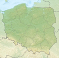
English: Location map of Poland
Equirectangular projection, N/S stretching 160 %. Geographic limits of the map:
- N: 55.2° N
- S: 48.7° N
- W: 13.8° E
- E: 24.5° E
This vector image includes elements that have been taken or adapted from this file:
This vector image includes elements that have been taken or adapted from this file:
-
 w/o rivers
 -
 w/ rivers
 -
 relief w/o rivers - PNG
 -
 relief w/ river - SVG


This map was created with Adobe Illustrator by TUBS.
Licensing
I, the copyright holder of this work, hereby publish it under the following license:
This file is licensed under the Creative Commons Attribution-Share Alike 3.0 Unported license.
- You are free:
- to share – to copy, distribute and transmit the work
- to remix – to adapt the work
- Under the following conditions:
- attribution – You must give appropriate credit, provide a link to the license, and indicate if changes were made. You may do so in any reasonable manner, but not in any way that suggests the licensor endorses you or your use.
- share alike – If you remix, transform, or build upon the material, you must distribute your contributions under the same or compatible license as the original.

|
I'd greatly appreciate, that you attribute this media file to Wikimedia Commons, if used outside Wikipedia or Commons. For use in publications such as books, newspapers, blogs, websites, please insert here the following line:
|


