This historical map image could be re-created using vector graphics as an SVG file. This has several advantages; see Commons:Media for cleanup for more information. If an SVG form of this image is available, please upload it and afterwards replace this template with {{vector version available|new image name}}.
It is recommended to name the SVG file “Resettlement of Circassians Into Ottoman Empire.svg”—then the template Vector version available (or Vva) does not need the new image name parameter.
This historical map image was uploaded in the JPEG format even though it consists of non-photographic data. This information could be stored more efficiently or accurately in the PNG or SVG format. If possible, please upload a PNG or SVG version of this image without compression artifacts, derived from a non-JPEG source (or with existing artifacts removed). After doing so, please tag the JPEG version with {{Superseded|NewImage.ext}} and remove this tag. This tag should not be applied to photographs or scans. If this image is a diagram or other image suitable for vectorisation, please tag this image with {{Convert to SVG}} instead of {{BadJPEG}}. If not suitable for vectorisation, use {{Convert to PNG}}. For more information, see {{BadJPEG}}.
Captions
Add a one-line explanation of what this file represents
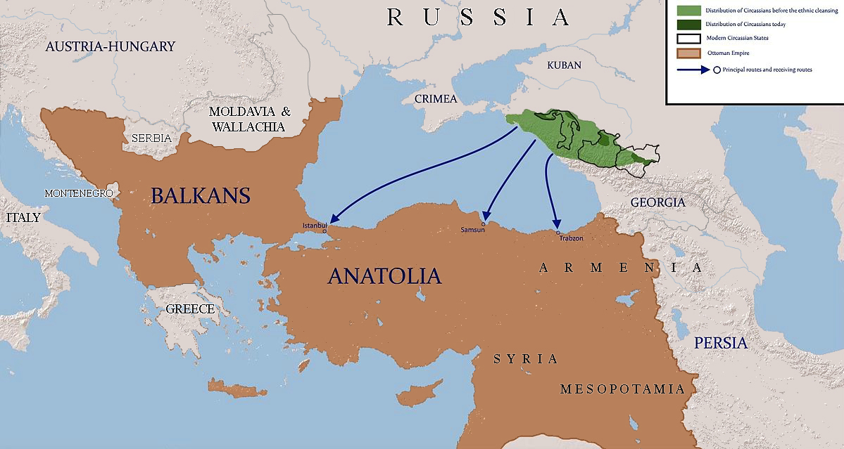
{{subst:Upload marker added by en.wp UW}} {{Information |Description = {{en|map shows the routes which were used to resettle circassians to ottoman empire}} |Source = using paint.net |Date = 2015-05-23 |Author = IrakliGuna }}


