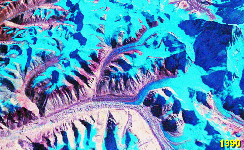
File:Rongbuk Glacier Animation.gif
The lower ~10 km of the glacier is moraine-covered. Its terminus (snout) is near the bottom left at the source of the Rongbuk River. There is no snout retreat over this interval, but the large increase in the area of meltwater lakes on the glacier surface suggests significant thinning. The big lake in the 2010 image is nearly 2 km long. Also note the reduction in glacier cover on the foothills to the left.
Stacked NASA World Wind images from the 1990 and 2000 NASA GeoCover collections and USGS Landsat 7 imagery from October 2009[1] (all Landsat 4/5 and Landsat 7 MSS/TM/ETM+ false-colour images). Diagonal lines in the 2010 image are due to the ETM+ scan line correction failure on Landsat 7.
worldwind://goto/world=Earth&lat=28.07778&lon=86.88972&alt=19166&dir=92.2&tilt=31.6
(This is an animated GIF image. If animation is not visible, it may be because Microsoft Office Picture Manager has your GIF file association. That application does not support GIF animation. Change the association to any standard picture viewer, and restart your browser.)


