Loading
  • 21 Aug, 2019

  • By, Wikipedia

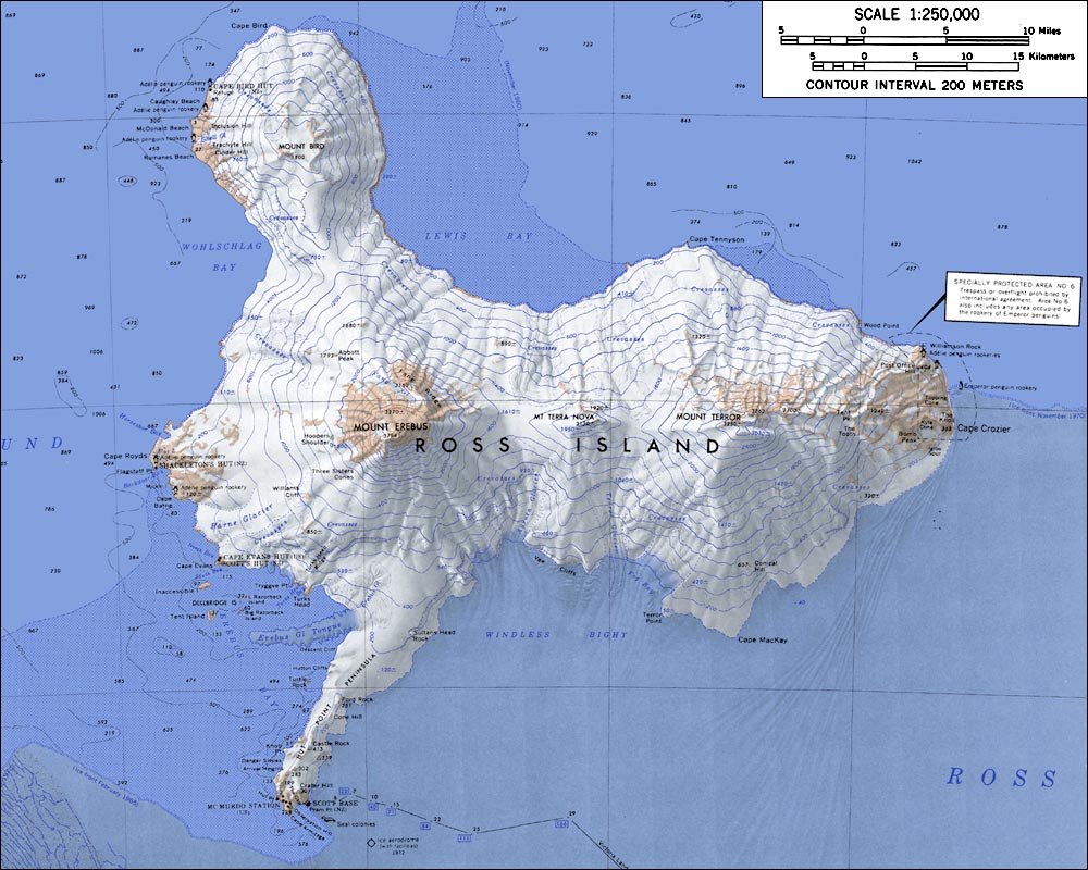
File:RossIslandMap.jpg


This file has been superseded by Ross Island Map USGS 250k.png. It is recommended to use the other file. Please note that deleting superseded images requires consent.

Reason to use the other file: "higher resolution and rendered in PNG"
new file

Licensing

Public domain
This image is in the public domain in the United States because it only contains materials that originally came from the United States Geological Survey, an agency of the United States Department of the Interior. For more information, see the official USGS copyright policy.

Bahasa Indonesia  català  čeština  Deutsch  eesti  English  español  français  galego  italiano  Nederlands  português  polski  sicilianu  suomi  Tiếng Việt  Türkçe  български  македонски  русский  മലയാളം  한국어  日本語  中文  中文(简体)  中文(繁體)  العربية  فارسی  +/−

File history

Click on a date/time to view the file as it appeared at that time.

Date/TimeThumbnailDimensionsUserComment
current00:30, 15 January 2005Thumbnail for version as of 00:30, 15 January 20051,000 × 800 (166 KB)GarciaB~commonswikiTopographic map of Ross Island (1:250,000 scale)
The following pages on the English Wikipedia use this file (pages on other projects are not listed):

Global file usage

The following other wikis use this file:

View more global usage of this file.

Metadata