File:Rova Map 1800.jpg
Click on a date/time to view the file as it appeared at that time.
| Date/Time | Thumbnail | Dimensions | User | Comment | |
|---|---|---|---|---|---|
| current | 01:51, 28 July 2011 | 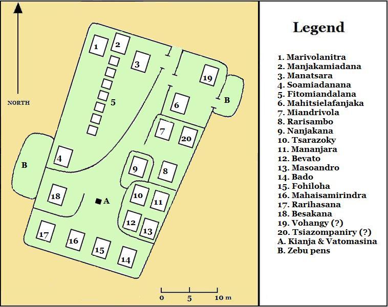 | 758 × 600 (75 KB) | Lemurbaby | entry to rova added |
| 01:34, 28 July 2011 |  | 758 × 600 (76 KB) | Lemurbaby | Cleaner lines, Vatomasina added | |
| 17:16, 17 January 2011 |  | 823 × 651 (108 KB) | Lemurbaby | {{Information |Description={{en|1=Map of the layout of the buildings within the Rova compound of Antananarivo, Madagascar, circa 1800}} Plan indiquant la distribution des structures a l'interieur du Rova de Tananarive, Madagascar, vers 1800 |Source={{own} |
File usage
The following page uses this file:
Global file usage
The following other wikis use this file:
- Usage on ca.wikipedia.org
- Usage on fr.wikipedia.org
- Usage on sl.wikipedia.org
- Usage on vi.wikipedia.org