File history
Click on a date/time to view the file as it appeared at that time.
| Date/Time | Thumbnail | Dimensions | User | Comment | |
|---|---|---|---|---|---|
| current | 01:21, 18 December 2009 | 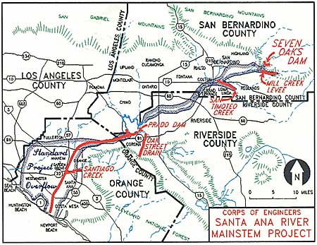 | 450 × 347 (48 KB) | Shannon1 | {{Information |Description={{en|1=Map of the 100-year floodplain of the Santa Ana river with flood control structures labelled}} |Source=http://www.ocflood.com/SARP.aspx |Author=U.S. Army Corps of Engineers |Date= |Permission= |other_versions= }} [[Categ |
File usage
The following pages on the English Wikipedia use this file (pages on other projects are not listed):
Global file usage
The following other wikis use this file:
- Usage on ja.wikipedia.org
- Usage on nl.wikipedia.org