Click on a date/time to view the file as it appeared at that time.
| Date/Time | Thumbnail | Dimensions | User | Comment |
|---|
| current | 03:14, 24 February 2020 | 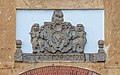 | 6,742 × 4,214 (13.04 MB) | A.Savin | {{User:A.Savin/F|L=0 |Description= {{en|Former warehouse in the Dutch Fort of Galle, Sri Lanka}} {{ru|Бывший портовый элеватор на территории Голландского форта в Галле, Шри-Ланка}} |Year=2020 |Country=Sri Lanka |Month=01 |Day=18}} {{Location|6|1|40.8|N|80|13|6.5|E|region:LK-3}} Category:Taken with Sony ILCE-7RM3 Category:Taken with Sony FE 24-105mm F4 G OSS Category:Galle Fort Warehouse Category:Reliefs in Sri Lanka |
The following pages on the English Wikipedia use this file (pages on other projects are not listed):
This file contains additional information, probably added from the digital camera or scanner used to create or digitize it.
If the file has been modified from its original state, some details may not fully reflect the modified file.
