File:Sakarya Districts.png
Click on a date/time to view the file as it appeared at that time.
| Date/Time | Thumbnail | Dimensions | User | Comment | |
|---|---|---|---|---|---|
| current | 18:47, 19 January 2014 | 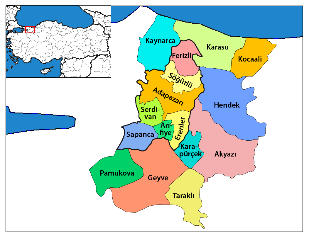 | 1,053 × 812 (88 KB) | Chumwa | Nach der letzten Gebietsreform ist der zentrale Landkreis (in der Karte zuvor "Sakarya Merkez") aufgeteilt worden in: Adapazarı, Arifiye, Erenler und Serdivan. Die Kreise, die zur Großstadtkommune Sakarya gehören, sind umrandet worden. |
| 01:58, 29 December 2008 |  | 1,056 × 816 (33 KB) | One Homo Sapiens | Corrected text where İ,Ş,ı,ğ,or ş occurs in name. Source: [statoids-com]. Increased font size and enhanced color differences among adjacent districts. | |
| 16:00, 12 April 2007 |  | 776 × 600 (110 KB) | KureCewlik81 | ||
| 17:12, 4 December 2006 |  | 1,056 × 816 (34 KB) | Rarelibra | Map of the districts of Sakarya province in Turkey. Created by ~~~~ for public domain use, using MapInfo Professional v8.5 and various mapping resources. |
File usage
The following pages on the English Wikipedia use this file (pages on other projects are not listed):
Global file usage
The following other wikis use this file:
- Usage on ar.wikipedia.org
- Usage on arz.wikipedia.org
- Usage on ast.wikipedia.org
- Usage on azb.wikipedia.org
- Usage on az.wikipedia.org
- Usage on be.wikipedia.org
- Usage on ca.wikipedia.org
- Usage on ceb.wikipedia.org
- Usage on ce.wikipedia.org
- Usage on cs.wikipedia.org
- Usage on cv.wikipedia.org
- Usage on de.wikipedia.org
- Usage on diq.wikipedia.org
- Usage on el.wikipedia.org
- Usage on en.wiktionary.org
- Usage on eo.wikipedia.org
- Usage on es.wikipedia.org
- Usage on et.wikipedia.org
- Usage on eu.wikipedia.org
- Usage on fa.wikipedia.org
- Usage on fi.wikipedia.org
View more global usage of this file.