Loading
  • 21 Aug, 2019

  • By, Wikipedia

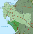
File:Saldanha Bay LM Topographic Map.svg

The ODbL does not require any particular license for maps produced from ODbL data. Prior to 1 August 2020, map tiles produced by the OpenStreetMap Foundation were licensed under the CC-BY-SA-2.0 license. Maps produced by other people may be subject to other licences.

SVG development
InfoField
 
The SVG code is valid.
 
This oversized map was created with Inkscape.
 
  This SVG map uses embedded raster graphics to show its topographic structures.

Captions

Add a one-line explanation of what this file represents

Items portrayed in this file

depicts

29 May 2021

image/svg+xml

8e5898bb8f3524b05f6e1786b395f1d4076b7c41

5,477,279 byte

1,120 pixel

1,080 pixel

File history

Click on a date/time to view the file as it appeared at that time.

Date/TimeThumbnailDimensionsUserComment
current22:51, 29 May 2021Thumbnail for version as of 22:51, 29 May 20211,080 × 1,120 (5.22 MB)Htonladd Atlantic Ocean label
19:33, 29 May 2021Thumbnail for version as of 19:33, 29 May 20211,080 × 1,120 (5.22 MB)Htonladd label on Berg River
19:27, 29 May 2021Thumbnail for version as of 19:27, 29 May 20211,080 × 1,120 (5.21 MB)Htonl== {{int:filedesc}} == {{Information |Description ={{en|1=Topographic map of the Saldanha Bay Local Municipality in South Africa.}} |Source ={{own}} |Author =Htonl |Date =2021-05-29 |Permission ={{self|cc-by-sa-3.0}}{{ODbL OpenStreetMap}} |other_versions = |other fields = {{Igen|Inkscape|v|+|!=t|>|s=m}} }} Category:Maps of local municipalities of the Western Cape Category:Maps by Htonl

The following page uses this file:

Global file usage

The following other wikis use this file:

Metadata