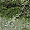
File:SanGabrielRiverCA ASTER 2005jan23.jpg
Click on a date/time to view the file as it appeared at that time.
| Date/Time | Thumbnail | Dimensions | User | Comment | |
|---|---|---|---|---|---|
| current | 20:25, 18 May 2006 |  | 540 × 540 (132 KB) | Holly Cheng | {{Information | Description=False-color satellite image of flood control efforts on the w:San Gabriel River (California). The image covers an area of 39.5 by 45.4 kilometers, and it is located near 34.1 degrees North latitude, 117.9 degrees West longi |
File usage
The following 4 pages use this file:
Global file usage
The following other wikis use this file:
- Usage on arz.wikipedia.org
- Usage on ceb.wikipedia.org
- Usage on sr.wikipedia.org
- Usage on www.wikidata.org