File:Sanborn A-Y-P Map.jpg
Click on a date/time to view the file as it appeared at that time.
| Date/Time | Thumbnail | Dimensions | User | Comment | |
|---|---|---|---|---|---|
| current | 20:26, 3 October 2008 | 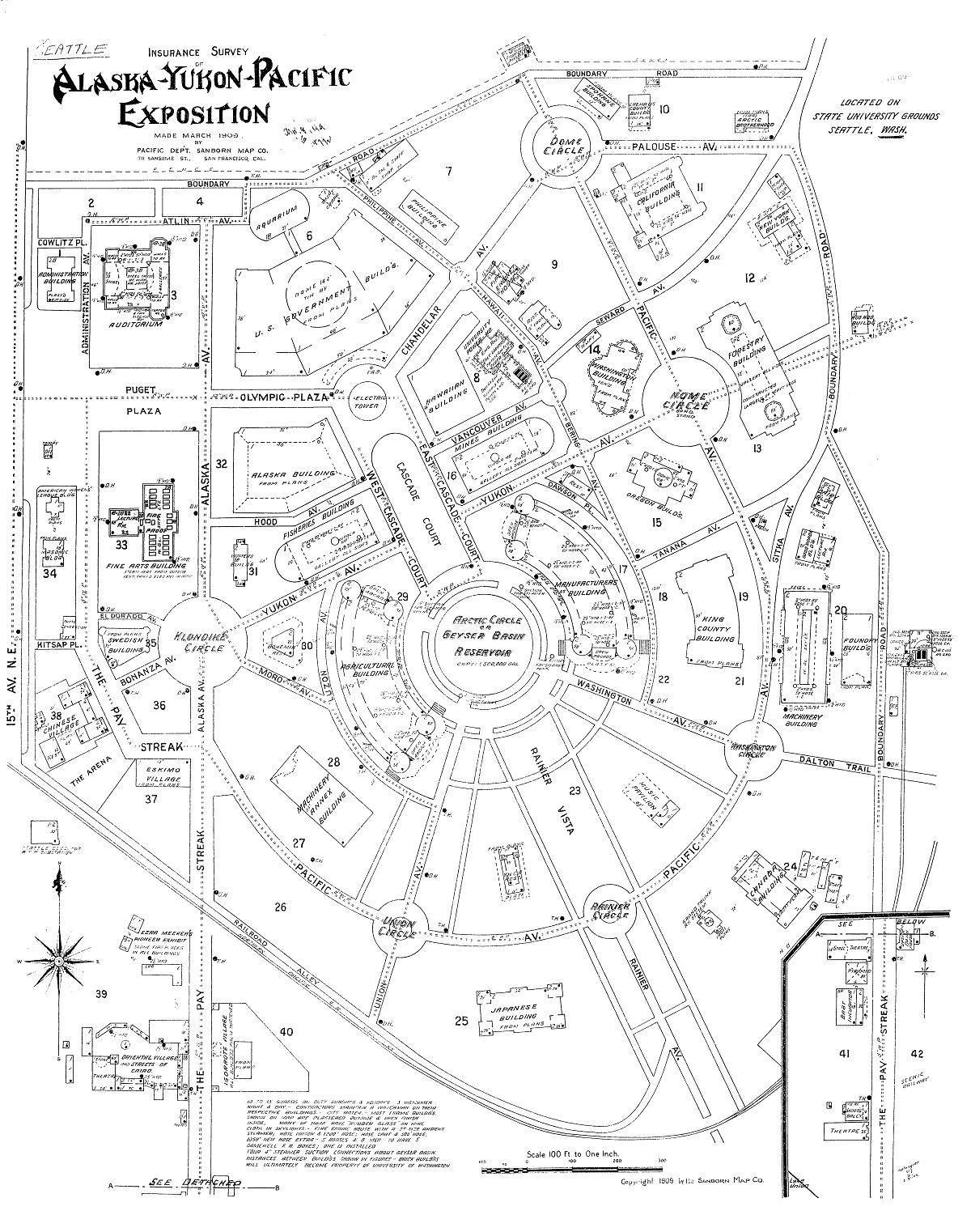 | 1,200 × 1,522 (390 KB) | Jmabel | == Summary == {{Information |Description=Map of the Alaska-Yukon-Pacific Exposition (the current University of Washington campus): Insurance Survey of Alaska-Yukon-Pacific Exposition |Source=Digital Sanborn Maps 1867-1970 |Date=March 1909 |Author=Pacific |
File usage
The following pages on the English Wikipedia use this file (pages on other projects are not listed):
Global file usage
The following other wikis use this file:
- Usage on nl.wikipedia.org
- Usage on no.wikipedia.org
- Usage on www.wikidata.org