File:Saqqez, Kurdistan Province Locator Map.svg
The ODbL does not require any particular license for maps produced from ODbL data. Prior to 1 August 2020, map tiles produced by the OpenStreetMap Foundation were licensed under the CC-BY-SA-2.0 license. Maps produced by other people may be subject to other licences.
Geotemporal data
Date depicted
31 July 2021
Map location
Kurdistan Province
Spatial reference system
Mercator
Bibliographic data
Language
English
Archival data
Notes
SVG development
Other versions
- See also: Category:Maps of Kurdistan Province
-
 Blank version
 -
 With labels
 -
 Baneh district
 -
 Bijar district
 -
 Dehgolan district
 -
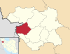
 Divandarreh district
 -
 Ghorveh district
 -
 Kamyran district
 -
 Marivan district
 -
 Sanandaj district
 -
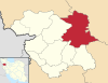
 Saqqez district
 -
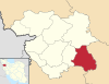
 Sarvabad district
.svg)
.svg)


